
فایل:Belarus adm location map.svg

فایلین اصلی (SVG فایلی، ۱٬۶۲۶ × ۱٬۴۵۱ پیکسئل، فایلین اؤلچوسو: ۲۳۸ کیلوبایت)
قیساسی
| آچیقلاما |
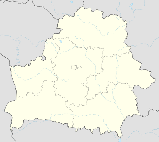
Deutsch: Positionskarte von Weißrussland
English: Location map of Belarus
|
||||||||||||
| تاریخ | |||||||||||||
| قایناق |
Own work using:
|
||||||||||||
| یازار | NordNordWest | ||||||||||||
| SVG genesis | کد مبدأ این پروندهٔ گرافیک برداری مقیاسپذیر، معتبر. این نقشهٔ جهان با Adobe Illustrator ساخته شده است
|
||||||||||||

لیسانس
Usage of this file with:

explanatory notes: Legally binding is only the full legalcode. For a free usage I recommend to respect the following licence conditions:
1. Provide my name as given above: NordNordWest,
2. a copy of, or the URI for, the applicable license: https://creativecommons.org/licenses/by-sa/3.0/de/legalcode,
3. the title of the work,
4. in the case of an adaptation, a credit identifying the use of the work in the adaptation.
This license and the rights granted hereunder will terminate automatically upon any breach by you of the terms of this license. Any of the above conditions can be waived if you get permission from the copyright holder. If you have questions or wish differing conditions, please contact me through nnwest or my discussion page ![]() t-online.de
t-online.de
- سیزین ایجازه نیز وار دیر:
- بؤلۆشمک – اثرین کپی، پایلاشماق و چاتدیرماسی اوچون
- تلفیق ائت – اثرین توتوشدورماسی اوچون
- آشاغی داکی شرایطله:
- تخصیص – اثری مؤلف و یا لیسئنزییالی طرفیندن گؤستریلدیی کیمی ایستیناد ائتملیسینیز (آنجاق سنی دستکلدیینی و یا اثردن ایستیفاده ائتمیینیزی تکلیف ائتمملیسینیز).
- بیرگه پایلاشیم – اگر بو اثرده دَییشدیرمه، چؤندرمه، یا دا کؤکدن دوزلتمه ائتسز، اله گلمیش اثری یالنیز بیر ائشیت یوخسا اوخشار بیر مجوزین آلتیندا یاییملایابیلرسینیز .

فايل گئچمیشی
فايلین اولکی وئرسیياسینی گؤرمک اۆچون گۆن/تاریخ بؤلمهسیندهکی تاریخلری تێقلايین.
| تاریخ/واخت | کیچیک عکس | اؤلچولر | ایشلدن | باخیش | |
|---|---|---|---|---|---|
| ایندیکی | ۶ مئی ۲۰۱۶، ساعت ۰۹:۵۱ | | ۱٬۶۲۶ در ۱٬۴۵۱ (۲۳۸ کیلوبایت) | NordNordWest | c |
| ۵ مئی ۲۰۱۶، ساعت ۱۶:۵۲ |  | ۱٬۶۲۶ در ۱٬۴۵۱ (۸۴۲ کیلوبایت) | NordNordWest | c | |
| ۱۰ سپتامبر ۲۰۱۴، ساعت ۱۹:۰۴ |  | ۱٬۶۲۶ در ۱٬۴۵۱ (۲۴۹ کیلوبایت) | NordNordWest | c | |
| ۱۰ سپتامبر ۲۰۱۴، ساعت ۱۸:۵۴ |  | ۱٬۶۲۶ در ۱٬۴۵۱ (۲۵۰ کیلوبایت) | NordNordWest | == {{int:filedesc}} == {{Information |Description= {{de|1=Positionskarte von Weißrussland}} {{en|1=Location map of Belarus}} {{Location map series N |top=56.4 |bottom=51.1 |left=22.9 |right=33.0 }} |Source={{Own using}} * United States National Imager... |
فايل ایشلدمهسی
آشاغیداکی 3 صحیفهلر بو فایلا باغلانیرلار
فایلین باشاباش ایشلنیلمهسی
بو فایل آشاغی داکی آیری ویکی لرده ایشلَنیر:
- af.wikipedia.org-ده ایشلنمهسی
- als.wikipedia.org-ده ایشلنمهسی
- ast.wikipedia.org-ده ایشلنمهسی
- Aeropuertu de Maguilov
- Minsk
- Raión de Berazino
- Raión de Chervyen
- Raión de Dzyarzhynsk
- Raión de Kapyl
- Raión de Kletsk
- Raión de Krupki
- Raión de Lagoysk
- Raión de Maladzyechna
- Raión de Minsk
- Raión de Myadzel
- Raión de Nesvizh
- Raión de Saligorsk
- Raión de Slutsk
- Raión de Smalyavichy
- Raión de Staryadarogui
- Raión de Valozhyn
- Raión de Vileyka
- Brest (Bielorrusia)
- Gómel
- Vítebsk
- Maguilov
- Grodno
- Borísov (Minsk)
- Babruisk
- Saligorsk
- Mazyr
- Orsha
- Pinsk
- Baránavichi
- Módulu:Mapa de llocalización/datos/Bielorrusia
- Módulu:Mapa de llocalización/datos/Bielorrusia/usu
- Aeropuertu Internacional de Minsk
- Aeropuertu de Gómel
- Žodzina
- Yeshivá de Volozhin
- Volozhyn
- Mir (Bielorrusia)
- ban.wikipedia.org-ده ایشلنمهسی
- be.wikipedia.org-ده ایشلنمهسی
بو فایلینسراسری ایستفاده لرینه باخین.