
فایل:Brandon railway station - the footbridge - geograph.org.uk - 1516141.jpg
یوخاری کیفیت الده یوخدور.
Brandon_railway_station_-_the_footbridge_-_geograph.org.uk_-_1516141.jpg (۶۴۰ × ۴۸۵ پیکسل, فایل اؤلچوسو: ۱۰۱ کیلوبایت, MIME نوعو: image/jpeg)
قیساسی
| آچیقلاما |
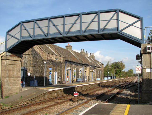
English: Brandon railway station - the footbridge A disk-type ground signal can be seen in the foreground. Brandon railway station serves the town of Brandon in Suffolk but the station is actually situated in Norfolk - on the other side of the county boundary. Before the re-introduction of a direct service between Cambridge and Norwich by Anglia Railways, Central Trains served the station as a stop on its route between Norwich and Liverpool, now operated by East Midlands Trains. Presently the station is managed by National Express East Anglia, with services east to Thetford, Attleborough, Wymondham and Norwich, and west to Ely and Cambridge. East Midlands Trains operates a single service to Norwich. The station has been un-staffed since the 1980s.
An initiative was launched in January 2006 by the Friends of Brandon Station aiming to improve the appearance and facilities, promote the fast and frequent services to Norwich, Ely and Cambridge, and to seek a new tenant for the station buildings |
| تاریخ | |
| قایناق | From geograph.org.uk |
| یازار | Evelyn Simak |
| موجَویز (required by the license) | Evelyn Simak / Brandon railway station - the footbridge / |
| مختصات دوربین | | محل قرارگیری این نگاره و سایر نگارهها در: نقشهٔ شهری باز |
|---|
_heading:90.00&language=azb)
| مختصات شیء | | محل قرارگیری این نگاره و سایر نگارهها در: نقشهٔ شهری باز |
|---|
_heading:90.00&language=azb)
لیسانس

|
این نگاره از مجموعهٔ پروژهٔ Geograph گرفته شدهاست. این صفحهٔ عکسها را در وبگاه Geograph برای جزئیات تماس با عکاس ببینید. حق تکثیر این تصویر به Evelyn Simak تعلق دارد و برای استفادهٔ مجدد تحت Creative Commons Attribution-ShareAlike 2.0 مجوزدهی شدهاست.
|
این پرونده با اجازهنامهٔ کریتیو کامانز Attribution-Share Alike 2.0 عمومی منتشر شدهاست.
موجَویز: Evelyn Simak
- سیزین ایجازه نیز وار دیر:
- بؤلۆشمک – اثرین کپی، پایلاشماق و چاتدیرماسی اوچون
- تلفیق ائت – اثرین توتوشدورماسی اوچون
- آشاغی داکی شرایطله:
- تخصیص – اثری مؤلف و یا لیسئنزییالی طرفیندن گؤستریلدیی کیمی ایستیناد ائتملیسینیز (آنجاق سنی دستکلدیینی و یا اثردن ایستیفاده ائتمیینیزی تکلیف ائتمملیسینیز).
- بیرگه پایلاشیم – اگر بو اثرده دَییشدیرمه، چؤندرمه، یا دا کؤکدن دوزلتمه ائتسز، اله گلمیش اثری یالنیز بیر ائشیت یوخسا اوخشار بیر مجوزین آلتیندا یاییملایابیلرسینیز .
فايل گئچمیشی
فايلین اولکی وئرسیياسینی گؤرمک اۆچون گۆن/تاریخ بؤلمهسیندهکی تاریخلری تێقلايین.
| تاریخ/واخت | کیچیک عکس | اؤلچولر | ایشلدن | باخیش | |
|---|---|---|---|---|---|
| ایندیکی | ۲ مارس ۲۰۱۱، ساعت ۲۳:۳۰ | | ۶۴۰ در ۴۸۵ (۱۰۱ کیلوبایت) | GeographBot | == {{int:filedesc}} == {{Information |description={{en|1=Brandon railway station - the footbridge A disk-type ground signal can be seen in the foreground. Brandon railway station serves the town of Brandon in Suffolk but the station is actually situated i |
فايل ایشلدمهسی
آشاغیداکی صحیفه بو فایلا باغلانیر
فایلین باشاباش ایشلنیلمهسی
بو فایل آشاغی داکی آیری ویکی لرده ایشلَنیر:
- en.wikipedia.org-ده ایشلنمهسی