
فایل:Colorado 82.svg

حجم پیشنمایش PNG این SVG file:۶۰۰ × ۶۰۰ پیکسل آیری کیفیتلر: ۲۴۰ × ۲۴۰ پیکسل | ۴۸۰ × ۴۸۰ پیکسل | ۷۶۸ × ۷۶۸ پیکسل | ۱٬۰۲۴ × ۱٬۰۲۴ پیکسل | ۲٬۰۴۸ × ۲٬۰۴۸ پیکسل | ۶۰۱ × ۶۰۱ پیکسل.
فایلین اصلی (SVG فایلی، ۶۰۱ × ۶۰۱ پیکسئل، فایلین اؤلچوسو: ۷ کیلوبایت)
قیساسی
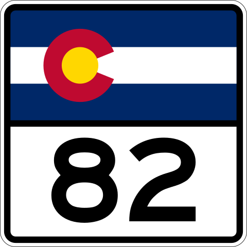
| آچیقلاما | 600 mm by 600 mm (24 in by 24 in) Colorado shield, made to the specifications of the Manual on Uniform Traffic Control Devices (MUTCD), 2003 Edition (sign M1-5). Uses the Roadgeek 2005 fonts. (United States law does not permit the copyrighting of typeface designs, and the fonts are meant to be copies of a U.S. Government-produced work anyway.) |
| تاریخ | |
| قایناق | یوکلهیهنین اؤز ایشی |
| یازار | Fredddie, originally by User:Atanamir, User:TwinsMetsFan, or User:Pzoxicuvybtnrm among others |
لیسانس
This file is in the public domain because it comes from the Colorado Supplement to the Federal Manual on Uniform Traffic Control Devices, which states that "the Transportation Commission of Colorado adopted the Federal Manual on Uniform Traffic Control Devices 2009, (MUTCD) for use in Colorado." It also states that "the Colorado Supplement has been established to adjust and interpret where necessary for the proper and lawful application of the MUTCD in Colorado in compliance with state statutes, and to address traffic regulatory situations not provided for in the MUTCD." The federal MUTCD states specifically on its page I-1 that:
No provisions of the supplement have adjusted or interpreted this provision of the MUTCD. |
فايل گئچمیشی
فايلین اولکی وئرسیياسینی گؤرمک اۆچون گۆن/تاریخ بؤلمهسیندهکی تاریخلری تێقلايین.
| تاریخ/واخت | کیچیک عکس | اؤلچولر | ایشلدن | باخیش | |
|---|---|---|---|---|---|
| ایندیکی | ۱۷ مارس ۲۰۱۲، ساعت ۲۳:۴۱ | | ۶۰۱ در ۶۰۱ (۷ کیلوبایت) | Fredddie | |
| ۱۷ آوریل ۲۰۰۷، ساعت ۱۵:۰۷ |  | ۳۹۰ در ۳۹۴ (۷ کیلوبایت) | Scott5114 | {{PD-self}} 082 |
فايل ایشلدمهسی
آشاغیداکی صحیفه بو فایلا باغلانیر
فایلین باشاباش ایشلنیلمهسی
بو فایل آشاغی داکی آیری ویکی لرده ایشلَنیر:
- de.wikipedia.org-ده ایشلنمهسی
- en.wikipedia.org-ده ایشلنمهسی
- Pitkin County, Colorado
- Lake County, Colorado
- Garfield County, Colorado
- Eagle County, Colorado
- Basalt, Colorado
- List of state highways in Colorado
- Independence Pass (Colorado)
- Colorado State Highway 82
- Top of the Rockies National Scenic Byway
- U.S. Route 6 in Colorado
- List of highways numbered 82
- Wikipedia:WikiProject U.S. Roads/Redirects/Colorado
- Interstate 70 in Colorado
- Colorado State Highway 133
- Southern Rocky Mountains
- Colorado State Highway 83
- Maroon Creek Bridge
- List of mountain passes in Colorado
- U.S. Route 24 in Colorado
- Colorado State Highway 79
- List of Rocky Mountain passes on the continental divide
- List of passes of the Rocky Mountains
- User:Central Corridor/VelociRFTA
- Template:VelociRFTA
- User:Central Corridor/List of Roaring Fork Transportation Authority bus routes
- User:ChryZ MUC/mountainpasseslist
- Collegiate Peaks Scenic Byway
- West Elk Loop Scenic and Historic Byway
- en.wikivoyage.org-ده ایشلنمهسی
- es.wikipedia.org-ده ایشلنمهسی
- et.wikipedia.org-ده ایشلنمهسی
- fa.wikipedia.org-ده ایشلنمهسی
- fr.wikipedia.org-ده ایشلنمهسی
- mr.wikipedia.org-ده ایشلنمهسی
- uz.wikipedia.org-ده ایشلنمهسی
- zh-min-nan.wikipedia.org-ده ایشلنمهسی
- zh.wikipedia.org-ده ایشلنمهسی