
فایل:Karte Salzkotten Le Coq 1805.png
فایلین اصلی (۱٬۲۰۰ × ۸۳۵ پیکسل, فایل اؤلچوسو: ۱٫۶۹ مگابایت, MIME نوعو: image/png)
| آچیقلاما |
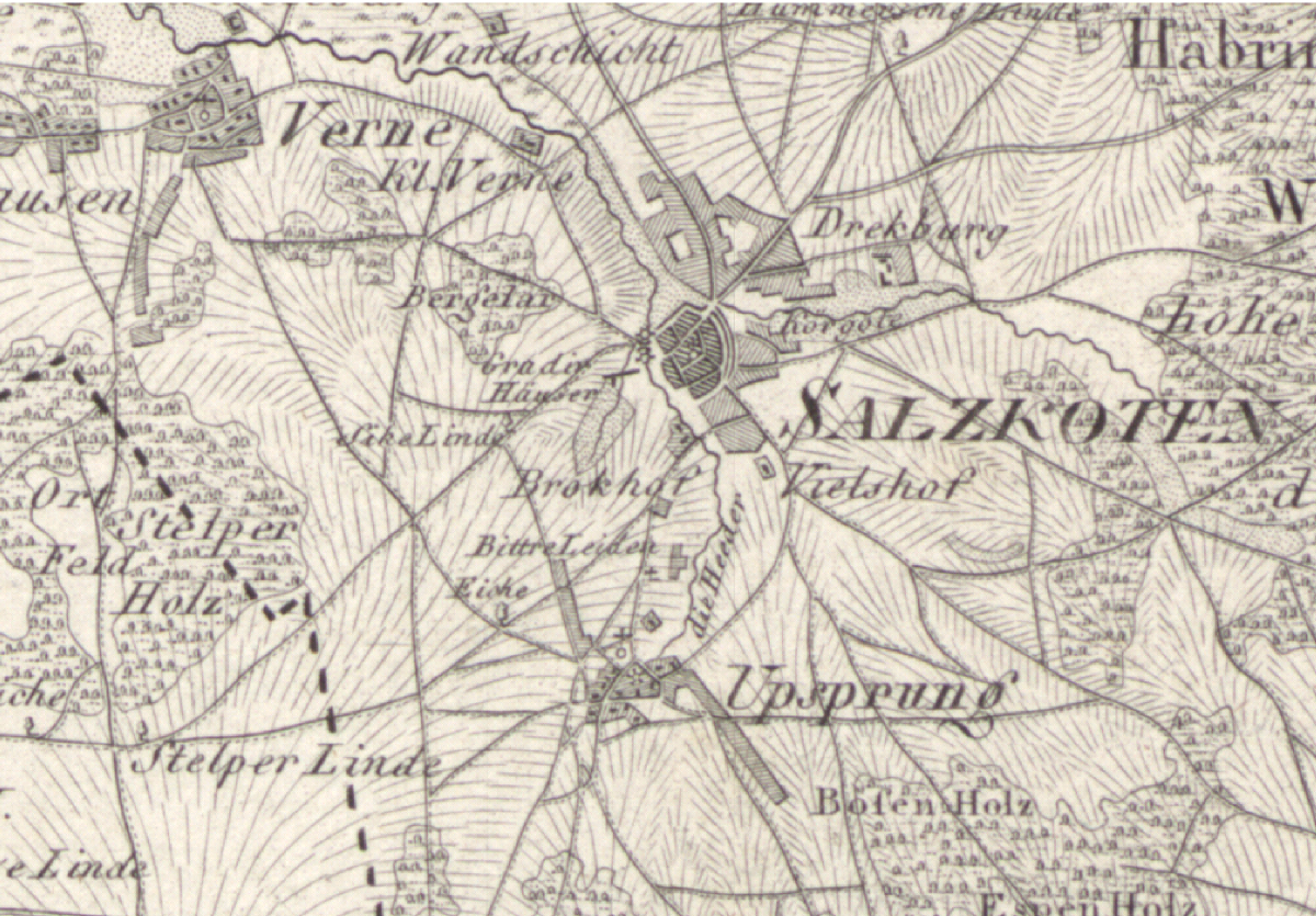
Deutsch: Karte von Salzkotten zu Beginn des 19. Jahrhunderts |
||||
| تاریخ | حوالی ۱۸۰۵ | ||||
| قایناق | Ausschnitt aus „Topographische Karte in XXII Blaettern den grösten Theil von Westphalen enthaltend [...], Section XVI“ | ||||
| یازار |
Herausgeber von Carl Ludwig von Le Coq (1805), Digitalisat des Landesarchivs Nordrhein-Westfalen Abteilung Westfalen | KSA 28580 |
||||
| ایجازه (فایلین تکرار ایستیفادهسی) |
|
||||
فايل گئچمیشی
فايلین اولکی وئرسیياسینی گؤرمک اۆچون گۆن/تاریخ بؤلمهسیندهکی تاریخلری تێقلايین.
| تاریخ/واخت | کیچیک عکس | اؤلچولر | ایشلدن | باخیش | |
|---|---|---|---|---|---|
| ایندیکی | ۱۲ فوریه ۲۰۰۹، ساعت ۰۵:۰۴ | | ۱٬۲۰۰ در ۸۳۵ (۱٫۶۹ مگابایت) | Ludger1961 | {{Information |Description={{de|Karte von Salzkotten zu Beginn des 19. Jahrhunderts}} |Source=Ausschnitt aus „[http://www.lwl.org/westfaelische-geschichte/kar-zoom/kar373-l.html Topographische Karte in XXII Blaettern den grösten Theil von Westphale |
فايل ایشلدمهسی
آشاغیداکی صحیفه بو فایلا باغلانیر
فایلین باشاباش ایشلنیلمهسی
بو فایل آشاغی داکی آیری ویکی لرده ایشلَنیر:
- de.wikipedia.org-ده ایشلنمهسی
- nl.wikipedia.org-ده ایشلنمهسی