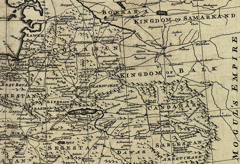
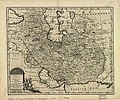
فایل:Map of Afghanistan during the Safavid and Moghul Empire.jpg

سیناق گؤستریشی اؤلچوسو: ۸۰۰ × ۵۴۸ پیکسل. آیری کیفیتلر: ۳۲۰ × ۲۱۹ پیکسل | ۶۴۰ × ۴۳۹ پیکسل | ۱٬۰۲۴ × ۷۰۲ پیکسل | ۱٬۲۸۰ × ۸۷۸ پیکسل | ۲٬۵۳۲ × ۱٬۷۳۶ پیکسل.
فایلین اصلی (۲٬۵۳۲ × ۱٬۷۳۶ پیکسل, فایل اؤلچوسو: ۱٫۱۶ مگابایت, MIME نوعو: image/jpeg)
فايل گئچمیشی
فايلین اولکی وئرسیياسینی گؤرمک اۆچون گۆن/تاریخ بؤلمهسیندهکی تاریخلری تێقلايین.
| تاریخ/واخت | کیچیک عکس | اؤلچولر | ایشلدن | باخیش | |
|---|---|---|---|---|---|
| ایندیکی | ۲ مارس ۲۰۱۱، ساعت ۰۲:۵۰ |  | ۲٬۵۳۲ در ۱٬۷۳۶ (۱٫۱۶ مگابایت) | Officer | {{Information |Description= |Source= |Date= |Author= |Permission= |other_versions= }} |
| ۲ مارس ۲۰۱۱، ساعت ۰۲:۴۲ |  | ۲٬۳۴۲ در ۱٬۶۸۲ (۱٫۰۴ مگابایت) | Officer | {{Information |Description= |Source= |Date= |Author= |Permission= |other_versions= }} | |
| ۲ مارس ۲۰۱۱، ساعت ۰۲:۳۲ |  | ۲٬۴۰۲ در ۱٬۵۹۹ (۱٫۰۲ مگابایت) | Officer | {{Information |Description= |Source= |Date= |Author= |Permission= |other_versions= }} | |
| ۲ مارس ۲۰۱۱، ساعت ۰۱:۳۷ |  | ۲٬۰۶۴ در ۱٬۶۰۷ (۸۵۶ کیلوبایت) | Officer | {{Information |Description= |Source= |Date= |Author= |Permission= |other_versions= }} | |
| ۱۲ مارس ۲۰۱۰، ساعت ۱۴:۳۹ |  | ۱٬۸۱۰ در ۱٬۸۱۰ (۹۱۵ کیلوبایت) | Officer | {{Information |Description=Map of Afghanistan during the Safavid and Mughal Empire, from the 16th century to 1747 when the current nation-state was created. |Source=[http://memory.loc.gov/ The Library of Congress, American Memory] - [http://memory.loc.gov | |
| ۲۱ ژانویه ۲۰۱۰، ساعت ۰۳:۴۸ |  | ۲٬۰۵۶ در ۱٬۵۷۴ (۹۸۳ کیلوبایت) | Officer | {{Information |Description=Map of Afghanistan during the Safavid and Mughal Empire, from the 16th century to 1747 when the current nation-state was created. |Source=[http://memory.loc.gov/ The Library of Congress, American Memory] - [http://memory.loc.gov | |
| ۱۹ نوْوامبر ۲۰۰۹، ساعت ۰۱:۲۹ |  | ۱٬۶۷۹ در ۱٬۶۷۸ (۷۹۰ کیلوبایت) | Officer | {{Information |Description=Map of Afghanistan during the Safavid and Mughal Empire, from the 16th century to 1747 when the current nation-state was created. |Source=[http://memory.loc.gov/ The Library of Congress, American Memory] - [http://memory.loc.gov |
فايل ایشلدمهسی
آشاغیداکی 4 صحیفهلر بو فایلا باغلانیرلار
فایلین باشاباش ایشلنیلمهسی
بو فایل آشاغی داکی آیری ویکی لرده ایشلَنیر:
- ar.wikipedia.org-ده ایشلنمهسی
- az.wikipedia.org-ده ایشلنمهسی
- bn.wikipedia.org-ده ایشلنمهسی
- el.wikipedia.org-ده ایشلنمهسی
- en.wikipedia.org-ده ایشلنمهسی
- fa.wikipedia.org-ده ایشلنمهسی
- hi.wikipedia.org-ده ایشلنمهسی
- id.wikipedia.org-ده ایشلنمهسی
- it.wikipedia.org-ده ایشلنمهسی
- ja.wikipedia.org-ده ایشلنمهسی
- nl.wikipedia.org-ده ایشلنمهسی
- no.wikipedia.org-ده ایشلنمهسی
- pnb.wikipedia.org-ده ایشلنمهسی
- pt.wikipedia.org-ده ایشلنمهسی
- ru.wikipedia.org-ده ایشلنمهسی
- ta.wikipedia.org-ده ایشلنمهسی
- te.wikipedia.org-ده ایشلنمهسی
- tg.wikipedia.org-ده ایشلنمهسی
- uk.wikipedia.org-ده ایشلنمهسی
- ur.wikipedia.org-ده ایشلنمهسی
- www.wikidata.org-ده ایشلنمهسی
- zh.wikipedia.org-ده ایشلنمهسی


