
فایل:Map of Indiana highlighting Tippecanoe County.svg

حجم پیشنمایش PNG این SVG file:۳۹۱ × ۵۹۹ پیکسل آیری کیفیتلر: ۱۵۶ × ۲۴۰ پیکسل | ۳۱۳ × ۴۸۰ پیکسل | ۵۰۱ × ۷۶۸ پیکسل | ۶۶۸ × ۱٬۰۲۴ پیکسل | ۱٬۳۳۷ × ۲٬۰۴۸ پیکسل | ۲٬۸۸۷ × ۴٬۴۲۳ پیکسل.
فایلین اصلی (SVG فایلی، ۲٬۸۸۷ × ۴٬۴۲۳ پیکسئل، فایلین اؤلچوسو: ۵۶ کیلوبایت)
قیساسی
| آچیقلاما |
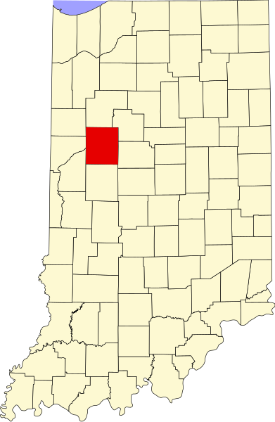
English: This is a locator map showing Tippecanoe County in Indiana. For more information, see Commons:United States county locator maps. |
| تاریخ | |
| قایناق |
یوکلهیهنین اؤز ایشی: English: The maps use data from nationalatlas.gov, specifically countyp020.tar.gz on the Raw Data Download page. The maps also use state outline data from statesp020.tar.gz. The Florida maps use hydrogm020.tar.gz to display Lake Okeechobee. |
| یازار | David Benbennick |
لیسانس
| من، دارنده حق تکثیر این اثر، این اثر را به مالکیت عمومی منتشر میکنم. این قابل اجرا در تمام نقاط جهان است. در برخی از کشورها ممکن است به صورت قانونی این امکانپذیر نباشد؛ اگر چنین است: من اجازهٔ استفاده از این اثر را برای هر مقصودی، بدون هیچگونه شرایطی میدهم، تا وقتی که این شرایط توسط قانون مستلزم نشده باشد. |
فايل گئچمیشی
فايلین اولکی وئرسیياسینی گؤرمک اۆچون گۆن/تاریخ بؤلمهسیندهکی تاریخلری تێقلايین.
| تاریخ/واخت | کیچیک عکس | اؤلچولر | ایشلدن | باخیش | |
|---|---|---|---|---|---|
| ایندیکی | ۱۲ فوریه ۲۰۰۶، ساعت ۱۲:۱۲ | | ۲٬۸۸۷ در ۴٬۴۲۳ (۵۶ کیلوبایت) | David Benbennick | {{subst:User:Dbenbenn/clm|county=Tippecanoe County|state=Indiana}} |
فايل ایشلدمهسی
آشاغیداکی 9 صحیفهلر بو فایلا باغلانیرلار
فایلین باشاباش ایشلنیلمهسی
بو فایل آشاغی داکی آیری ویکی لرده ایشلَنیر:
- ar.wikipedia.org-ده ایشلنمهسی
- arz.wikipedia.org-ده ایشلنمهسی
- bg.wikipedia.org-ده ایشلنمهسی
- bpy.wikipedia.org-ده ایشلنمهسی
- ca.wikipedia.org-ده ایشلنمهسی
- cdo.wikipedia.org-ده ایشلنمهسی
- ceb.wikipedia.org-ده ایشلنمهسی
- cy.wikipedia.org-ده ایشلنمهسی
- de.wikipedia.org-ده ایشلنمهسی
- en.wikipedia.org-ده ایشلنمهسی
- List of counties in Indiana
- Tippecanoe County, Indiana
- Otterbein, Indiana
- Battle Ground, Indiana
- Clarks Hill, Indiana
- Dayton, Indiana
- Lafayette, Indiana
- Shadeland, Indiana
- West Lafayette, Indiana
- Fort Ouiatenon
- Wabash Heritage Trail
- Jerry E. Clegg Botanic Garden
- Romney, Indiana
- Wabash Township, Tippecanoe County, Indiana
- Americus, Indiana
- Buck Creek, Indiana
- Colburn, Indiana
- Glen Hall, Indiana
- Heath, Indiana
- Montmorenci, Indiana
- Monroe, Tippecanoe County, Indiana
- Odell, Indiana
- Stockwell, Indiana
- Monitor, Indiana
- South Raub, Indiana
- Taylor, Indiana
- North Crane, Indiana
- West Point, Indiana
- Granville, Indiana
- Tippecanoe Battlefield Park
- Lafayette station (Indiana)
- Corwin, Tippecanoe County, Indiana
- Beeville, Indiana
بو فایلینسراسری ایستفاده لرینه باخین.