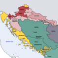
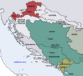
فایل:Map of the Kingdom of Croatia (1868).png
Map_of_the_Kingdom_of_Croatia_(1868).png (۵۴۲ × ۵۰۲ پیکسل, فایل اؤلچوسو: ۴۰ کیلوبایت, MIME نوعو: image/png)
فايل گئچمیشی
فايلین اولکی وئرسیياسینی گؤرمک اۆچون گۆن/تاریخ بؤلمهسیندهکی تاریخلری تێقلايین.
| تاریخ/واخت | کیچیک عکس | اؤلچولر | ایشلدن | باخیش | |
|---|---|---|---|---|---|
| ایندیکی | ۱۰ نوْوامبر ۲۰۲۲، ساعت ۱۸:۳۵ |  | ۵۴۲ در ۵۰۲ (۴۰ کیلوبایت) | CarRadovan | Reverted to version as of 22:47, 17 December 2016 (UTC) |
| ۱۲ فوریه ۲۰۱۷، ساعت ۰۴:۴۳ |  | ۵۴۲ در ۵۵۲ (۳۹ کیلوبایت) | Ceha | Reverted to version as of 10:26, 17 December 2016 (UTC) as discussed before | |
| ۱۷ دسامبر ۲۰۱۶، ساعت ۲۲:۴۷ |  | ۵۴۲ در ۵۰۲ (۴۰ کیلوبایت) | Lilic | Reverted to version as of 11:51, 13 October 2009 (UTC) reverting to author's original map, as it is in fact better | |
| ۱۷ دسامبر ۲۰۱۶، ساعت ۱۰:۲۶ |  | ۵۴۲ در ۵۵۲ (۳۹ کیلوبایت) | Ceha | Showed croatian aspirations (pale orange), marked Slavonia as area which sended representatives in croatian parliament, as well as military borders which were part (at least in it's names) of Croatia and Slavonia. | |
| ۱۳ اوْکتوبر ۲۰۰۹، ساعت ۱۱:۵۱ |  | ۵۴۲ در ۵۰۲ (۴۰ کیلوبایت) | DIREKTOR | {{Information |Description={{en|1=Map of the Kingdom of Croatia (red) in late 1867 and early 1868 (before the Croatian-Hungarian Nagodba and the establishment of the Kingdom of Croatia-Slavonia). The Kingdom of Slavonia was independent of Croatia at the t | |
| ۱۳ اوْکتوبر ۲۰۰۹، ساعت ۱۱:۴۹ |  | ۵۴۲ در ۵۰۲ (۴۰ کیلوبایت) | DIREKTOR | {{Information |Description={{en|1=Map of the Kingdom of Croatia (red) in late 1867 and early 1868 (before the Croatian-Hungarian Nagodba and the establishment of the Kingdom of Croatia-Slavonia). The Kingdom of Slavonia was independent of Croatia at the t | |
| ۱۳ اوْکتوبر ۲۰۰۹، ساعت ۱۱:۴۵ |  | ۵۴۲ در ۵۰۲ (۴۰ کیلوبایت) | DIREKTOR | {{Information |Description={{en|1=Map of the Kingdom of Croatia (red) in late 1867 and early 1868 (before the Croatian-Hungarian Nagodba and the establishment of the Kingdom of Croatia-Slavonia). The Kingdom of Slavonia was independent of Croatia at the t | |
| ۱۱ اوْکتوبر ۲۰۰۹، ساعت ۱۰:۰۴ |  | ۵۴۲ در ۵۰۲ (۳۹ کیلوبایت) | DIREKTOR | {{Information |Description={{en|1=Map of the Kingdom of Croatia (red) in late 1867 and early 1868 (before the Croatian-Hungarian Nagodba and the establishment of the Kingdom of Croatia-Slavonia). The Kingdom of Slavonia was independent of Croatia at the t | |
| ۸ اوْکتوبر ۲۰۰۹، ساعت ۱۶:۳۹ |  | ۵۴۲ در ۵۰۲ (۳۸ کیلوبایت) | DIREKTOR | {{Information |Description={{en|1=Map of the Kingdom of Croatia (red) in late 1867 and early 1868 (before the Croatian-Hungarian Nagodba and the establishment of the Kingdom of Croatia-Slavonia). The Kingdom of Slavonia was independent of Croatia at the t | |
| ۸ اوْکتوبر ۲۰۰۹، ساعت ۱۲:۴۷ |  | ۵۴۲ در ۵۰۲ (۳۸ کیلوبایت) | DIREKTOR | {{Information |Description={{en|1=Map of the Kingdom of Croatia (red) in late 1867 and early 1868 (before the Croatian-Hungarian Nagodba and the establishment of the Kingdom of Croatia-Slavonia). The Kingdom of Slavonia was independent of Croatia at the t |
فايل ایشلدمهسی
آشاغیداکی 2 صحیفهلر بو فایلا باغلانیرلار
فایلین باشاباش ایشلنیلمهسی
بو فایل آشاغی داکی آیری ویکی لرده ایشلَنیر:
- bg.wikipedia.org-ده ایشلنمهسی
- bs.wikipedia.org-ده ایشلنمهسی
- cs.wikipedia.org-ده ایشلنمهسی
- el.wikipedia.org-ده ایشلنمهسی
- en.wikipedia.org-ده ایشلنمهسی
- es.wikipedia.org-ده ایشلنمهسی
- et.wikipedia.org-ده ایشلنمهسی
- eu.wikipedia.org-ده ایشلنمهسی
- fi.wikipedia.org-ده ایشلنمهسی
- hu.wikipedia.org-ده ایشلنمهسی
- it.wikipedia.org-ده ایشلنمهسی
- ja.wikipedia.org-ده ایشلنمهسی
- ko.wikipedia.org-ده ایشلنمهسی
- lv.wikipedia.org-ده ایشلنمهسی
- mk.wikipedia.org-ده ایشلنمهسی
- nl.wikipedia.org-ده ایشلنمهسی
- pt.wikipedia.org-ده ایشلنمهسی
- ro.wikipedia.org-ده ایشلنمهسی
- ru.wikipedia.org-ده ایشلنمهسی
- sh.wikipedia.org-ده ایشلنمهسی
- sl.wikipedia.org-ده ایشلنمهسی
- sr.wikipedia.org-ده ایشلنمهسی
- sv.wikipedia.org-ده ایشلنمهسی
- tr.wikipedia.org-ده ایشلنمهسی
- uk.wikipedia.org-ده ایشلنمهسی
- www.wikidata.org-ده ایشلنمهسی

