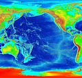
فایل:Pacific elevation.jpg

سیناق گؤستریشی اؤلچوسو: ۶۳۲ × ۵۹۹ پیکسل. آیری کیفیتلر: ۲۵۳ × ۲۴۰ پیکسل | ۵۰۶ × ۴۸۰ پیکسل | ۸۱۰ × ۷۶۸ پیکسل | ۱٬۰۸۰ × ۱٬۰۲۴ پیکسل | ۲٬۵۰۰ × ۲٬۳۷۰ پیکسل.
فایلین اصلی (۲٬۵۰۰ × ۲٬۳۷۰ پیکسل, فایل اؤلچوسو: ۸۹۹ کیلوبایت, MIME نوعو: image/jpeg)
فايل گئچمیشی
فايلین اولکی وئرسیياسینی گؤرمک اۆچون گۆن/تاریخ بؤلمهسیندهکی تاریخلری تێقلايین.
| تاریخ/واخت | کیچیک عکس | اؤلچولر | ایشلدن | باخیش | |
|---|---|---|---|---|---|
| ایندیکی | ۷ مارس ۲۰۰۶، ساعت ۰۳:۴۱ |  | ۲٬۵۰۰ در ۲٬۳۷۰ (۸۹۹ کیلوبایت) | Interiot~commonswiki | Elevation of the Pacific ocean Source: http://www.ngdc.noaa.gov/mgg/image/2minrelief.html |
فايل ایشلدمهسی
آشاغیداکی صحیفه بو فایلا باغلانیر
فایلین باشاباش ایشلنیلمهسی
بو فایل آشاغی داکی آیری ویکی لرده ایشلَنیر:
- als.wikipedia.org-ده ایشلنمهسی
- ang.wikipedia.org-ده ایشلنمهسی
- ar.wikipedia.org-ده ایشلنمهسی
- avk.wikipedia.org-ده ایشلنمهسی
- az.wikipedia.org-ده ایشلنمهسی
- bat-smg.wikipedia.org-ده ایشلنمهسی
- be.wikipedia.org-ده ایشلنمهسی
- bg.wikipedia.org-ده ایشلنمهسی
- bn.wikipedia.org-ده ایشلنمهسی
- bs.wikipedia.org-ده ایشلنمهسی
- ca.wikipedia.org-ده ایشلنمهسی
- ceb.wikipedia.org-ده ایشلنمهسی
- chr.wikipedia.org-ده ایشلنمهسی
- crh.wikipedia.org-ده ایشلنمهسی
- cs.wikipedia.org-ده ایشلنمهسی
- da.wikipedia.org-ده ایشلنمهسی
- de.wikipedia.org-ده ایشلنمهسی
- de.wiktionary.org-ده ایشلنمهسی
- dsb.wikipedia.org-ده ایشلنمهسی
- en.wikipedia.org-ده ایشلنمهسی
- en.wikibooks.org-ده ایشلنمهسی
- es.wikipedia.org-ده ایشلنمهسی
- et.wikipedia.org-ده ایشلنمهسی
- ext.wikipedia.org-ده ایشلنمهسی
- fa.wikipedia.org-ده ایشلنمهسی
- fiu-vro.wikipedia.org-ده ایشلنمهسی
- fi.wikipedia.org-ده ایشلنمهسی
- fj.wikipedia.org-ده ایشلنمهسی
- frr.wikipedia.org-ده ایشلنمهسی
- fy.wikipedia.org-ده ایشلنمهسی
- gan.wikipedia.org-ده ایشلنمهسی
- gd.wikipedia.org-ده ایشلنمهسی
- gl.wikipedia.org-ده ایشلنمهسی
- he.wikipedia.org-ده ایشلنمهسی
- hif.wikipedia.org-ده ایشلنمهسی
- hr.wikipedia.org-ده ایشلنمهسی
- hsb.wikipedia.org-ده ایشلنمهسی
- hu.wikipedia.org-ده ایشلنمهسی
بو فایلینسراسری ایستفاده لرینه باخین.

