
فایل:United Kingdom of the Netherlands 1815.svg

حجم پیشنمایش PNG این SVG file:۴۵۰ × ۴۵۶ پیکسل آیری کیفیتلر: ۲۳۷ × ۲۴۰ پیکسل | ۴۷۴ × ۴۸۰ پیکسل | ۷۵۸ × ۷۶۸ پیکسل | ۱٬۰۱۱ × ۱٬۰۲۴ پیکسل | ۲٬۰۲۱ × ۲٬۰۴۸ پیکسل.
فایلین اصلی (SVG فایلی، ۴۵۰ × ۴۵۶ پیکسئل، فایلین اؤلچوسو: ۷۰۰ کیلوبایت)
قیساسی


.svg)
.svg)
.svg)
.svg)
.svg)


.svg)
.svg)
.svg)


.png)
.png)


.svg)


.svg)

.svg)


.svg)
.svg)
.svg)
.svg)


.svg)
.png)


.svg)


.svg)
.svg)


.svg)


.svg)


.svg)
.svg)
.svg)
.svg)
.svg)
.svg)
.svg)
_cropped.svg)
.svg)
.svg)
.svg)
.svg)
.svg)
.svg)
.svg)
.svg)
.svg)
.svg)
.svg)
.svg)
.svg)
.svg)
.svg)
.svg)
.svg)
.svg)
.svg)
.svg)
.svg)
.svg)
.svg)
.svg)
.svg)
.svg)
.svg)
.svg)
.svg)
.svg)
.svg)
.svg)
.svg)
.svg)
.svg)
.svg)
.svg)
.svg)
.svg)
.svg)
.svg)
.svg)
.svg)
.svg)
.svg)
لیسانس
بو فایل کریتیو کامانز مجوز ایله Attribution-Share Alike 3.0 اویغونلاشمامیش یاییملانیبدیر.
- سیزین ایجازه نیز وار دیر:
- بؤلۆشمک – اثرین کپی، پایلاشماق و چاتدیرماسی اوچون
- تلفیق ائت – اثرین توتوشدورماسی اوچون
- آشاغی داکی شرایطله:
- تخصیص – اثری مؤلف و یا لیسئنزییالی طرفیندن گؤستریلدیی کیمی ایستیناد ائتملیسینیز (آنجاق سنی دستکلدیینی و یا اثردن ایستیفاده ائتمیینیزی تکلیف ائتمملیسینیز).
- بیرگه پایلاشیم – اگر بو اثرده دَییشدیرمه، چؤندرمه، یا دا کؤکدن دوزلتمه ائتسز، اله گلمیش اثری یالنیز بیر ائشیت یوخسا اوخشار بیر مجوزین آلتیندا یاییملایابیلرسینیز .
اورجینال یوکلمه گوندهلیگی
This image is a derivative work of the following images:
- File:Blank_map_of_Europe.svg licensed with Cc-by-sa-2.5
- 2012-02-21T16:27:27Z Alphathon 680x520 (614699 Bytes) Updated Metadata and the boarders/coastlines along the western coast of the Black Sea
- 2011-09-19T22:57:58Z Alphathon 680x520 (603759 Bytes) Added North/Northern Cyprus
- 2011-08-23T10:26:48Z Heb 680x520 (604212 Bytes) Added [[:en:Bornholm]] (taken from [[:File:Denmark blank map.svg]])
- 2011-04-12T00:40:40Z Alphathon 680x520 (602549 Bytes) Upgraded Sicily based on "File:Freeworldmaps-sicily.jpg". Upgraded Malta based on "File:Map of Malta 2.png". Simplified Croatian borders.
- 2011-04-10T21:43:04Z Alphathon 680x520 (607359 Bytes) Upgraded Croatia, Bosnia & Herzegovina, Slovenia and surrounding countries based on data from "File:Kroatien - Politische Gliederung (Karte).png"
- 2011-04-10T20:05:09Z Alphathon 680x520 (568373 Bytes) Improved Serbia, Montenegro and surrounding countries using data from "File:Serbia Map.png". Fixed Serbia-Montenegro border. Added Kosovo (using dashed border, since it is not a universally recognised nation, and left the lan
- 2011-04-10T15:55:02Z Alphathon 680x520 (524980 Bytes) Tweaked Ukraine and surrounding countries based on data from "File:Up-map.png"
- 2011-04-10T04:02:09Z Alphathon 680x520 (511168 Bytes) Improved Greece, Albania, F.Y.R. Macedonia and Bulgaria based on "File:Greece topo.jpg"
- 2011-04-10T02:48:52Z Alphathon 680x520 (505569 Bytes) Tweaked Germany and surrounding countries based on info from "File:Germany_general_map.png"
- 2011-04-10T01:54:05Z Alphathon 680x520 (493733 Bytes) Converted all lakes back to separate layer. Added Finish lakes and tweaked Finland shape based on "File:Finland 1996 CIA map.jpg". Added Swiss lakes based on "File:Suisse cantons.svg". Tweaked Scotland and added Lochs.
- 2011-04-10T00:07:54Z Alphathon 680x520 (450120 Bytes) Improved England outline and added Isle of Wight based on "File:England Regions - Blank.svg". Improved Denmark based on "File:2 digit postcode danmark.png". Improved Sweden based on "File:Map of Sweden, CIA, 1996.jpg"
- 2011-04-08T15:53:07Z Alphathon 680x520 (438878 Bytes) Upgraded/fixed various parts of the map. Details: *Some minor fixes to Ireland and added some of the larger lakes based on [[:File:Ireland_trad_counties_named.svg]] *Pretty major fixes to Scotland (mainly the west coast and i
- 2008-09-17T09:50:25Z F7 680x520 (531491 Bytes)
- 2008-09-17T09:42:57Z F7 680x520 (2353 Bytes)
- 2008-05-26T19:04:07Z Collard 680x520 (531491 Bytes) uploading on behalf of [[User:Checkit]], direct complaints to him plox: 'Moved countries out of the "outlines" group, removed "outlines" style class, remove separate style information for Russia'
- 2008-04-30T01:38:52Z TimothyBourke 680x520 (531767 Bytes) Changed the country code of Serbia to RS per [http://en.wikipedia.org/wiki/Serbian_country_codes] and the file [http://www.iso.org/iso/iso3166_en_code_lists.txt].
- 2008-02-08T22:44:37Z CarolSpears 680x520 (531767 Bytes) validated
- 2007-07-10T11:47:59Z MrWeeble 680x520 (533112 Bytes) Updated to include British Crown Dependencies as seperate entities and regroup them as "British Islands", with some simplifications to the XML and CSS
- 2007-05-14T17:17:34Z Zirland 680x520 (540659 Bytes) serbia and montenegro
- 2007-03-30T20:40:49Z W!B: 680x520 (538830 Bytes) minor corr: update nl:Ijsselmeer, del fi:lakes (all small), add ru:lake Oneka (all ref maps.google), glued northern irland back to ie ;)
- 2007-02-05T18:44:32Z Maix 680x520 (538295 Bytes) cropped
- 2007-02-04T15:07:29Z Maix 680x520 (538310 Bytes) {{Information |Description=A blank Map of Europe in SVG format. Every country has an id which is its ISO-3116-1-ALPHA2 code in lower case for easy coloring. |Source=Image based on [[Image:Europe_countries.svg|]] by [[User:Ti
Uploaded with derivativeFX
فايل گئچمیشی
فايلین اولکی وئرسیياسینی گؤرمک اۆچون گۆن/تاریخ بؤلمهسیندهکی تاریخلری تێقلايین.
| تاریخ/واخت | کیچیک عکس | اؤلچولر | ایشلدن | باخیش | |
|---|---|---|---|---|---|
| ایندیکی | ۱۱ آقوست ۲۰۱۳، ساعت ۰۳:۵۵ | | ۴۵۰ در ۴۵۶ (۷۰۰ کیلوبایت) | Alphathon | Fixed error near Königsberg |
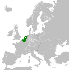
| ۱۱ آقوست ۲۰۱۳، ساعت ۰۳:۲۰ |  | ۴۵۰ در ۴۵۶ (۶۹۸ کیلوبایت) | Alphathon | == {{int:filedesc}} == {{Information |Description={{en|Map of the en:United Kingdom of the Netherlands, circa 1815, following the Congress of Vienna.}}{{de|Eine Landkarte des [[:de:Großherzogtum Luxemburg|Großherzogtu... |
فايل ایشلدمهسی
آشاغیداکی صحیفه بو فایلا باغلانیر
فایلین باشاباش ایشلنیلمهسی
بو فایل آشاغی داکی آیری ویکی لرده ایشلَنیر:
- af.wikipedia.org-ده ایشلنمهسی
- ar.wikipedia.org-ده ایشلنمهسی
- ast.wikipedia.org-ده ایشلنمهسی
- bg.wikipedia.org-ده ایشلنمهسی
- cs.wikipedia.org-ده ایشلنمهسی
- de.wikipedia.org-ده ایشلنمهسی
- en.wikipedia.org-ده ایشلنمهسی
- eo.wikipedia.org-ده ایشلنمهسی
- es.wikipedia.org-ده ایشلنمهسی
- et.wikipedia.org-ده ایشلنمهسی
- eu.wikipedia.org-ده ایشلنمهسی
- fa.wikipedia.org-ده ایشلنمهسی
- fi.wikipedia.org-ده ایشلنمهسی
- fr.wikipedia.org-ده ایشلنمهسی
- gl.wikipedia.org-ده ایشلنمهسی
- he.wikipedia.org-ده ایشلنمهسی
- id.wikipedia.org-ده ایشلنمهسی
- is.wikipedia.org-ده ایشلنمهسی
- it.wikipedia.org-ده ایشلنمهسی
- ja.wikipedia.org-ده ایشلنمهسی
- ko.wikipedia.org-ده ایشلنمهسی
- ms.wikipedia.org-ده ایشلنمهسی
- mt.wikipedia.org-ده ایشلنمهسی
- nl.wikipedia.org-ده ایشلنمهسی
- ru.wikipedia.org-ده ایشلنمهسی
- th.wikipedia.org-ده ایشلنمهسی
- uk.wikipedia.org-ده ایشلنمهسی
- vi.wikipedia.org-ده ایشلنمهسی
- www.wikidata.org-ده ایشلنمهسی
- zh.wikipedia.org-ده ایشلنمهسی