مشلنقتسه
Myślenice County
Powiat myślenicki | |
|---|---|
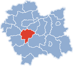
 Location within the voivodeship | |
| موختصاتلار (Myślenice): 49°50′N 19°56′E / 49.833°N 19.933°Eموختصات: 49°50′N 19°56′E / 49.833°N 19.933°E | |
| اؤلکه | |
| Voivodeship | کیچیک لهیستان اوستانی |
| Seat | Myślenice |
| Gminas | |
| اراضی | |
| • Total | ۶۷۳٫۳ km2 (۲۶۰�۰ sq mi) |
| جمعیت (2006) | |
| • Total | ۱۱۶٬۷۹۳ |
| • سیخلیق | ۱۷۰/km2 (۴۵۰/sq mi) |
| • شهر | ۳۰٬۴۰۳ |
| • Rural | ۸۶٬۳۹۰ |
| Car plates | KMY |
| وئب سایت | http://www.powiat-myslenice.pl |
مشلنقتسه (لهیستانجا: Myślenice County) لهیستاندا بیر یاشاییش منطقهسیدیر 673.3 کیلومتر موربّع ساحهسی وار. و کیچیک لهیستان اوستانیندا یئرلشیر.


