
فایل:Haryana locator map.svg

حجم پیشنمایش PNG این SVG file:۴۸۱ × ۵۹۹ پیکسل آیری کیفیتلر: ۱۹۳ × ۲۴۰ پیکسل | ۳۸۵ × ۴۸۰ پیکسل | ۶۱۷ × ۷۶۸ پیکسل | ۸۲۲ × ۱٬۰۲۴ پیکسل | ۱٬۶۴۵ × ۲٬۰۴۸ پیکسل | ۹۵۴ × ۱٬۱۸۸ پیکسل.
فایلین اصلی (SVG فایلی، ۹۵۴ × ۱٬۱۸۸ پیکسئل، فایلین اؤلچوسو: ۸۳ کیلوبایت)
| عنوان مقاله |
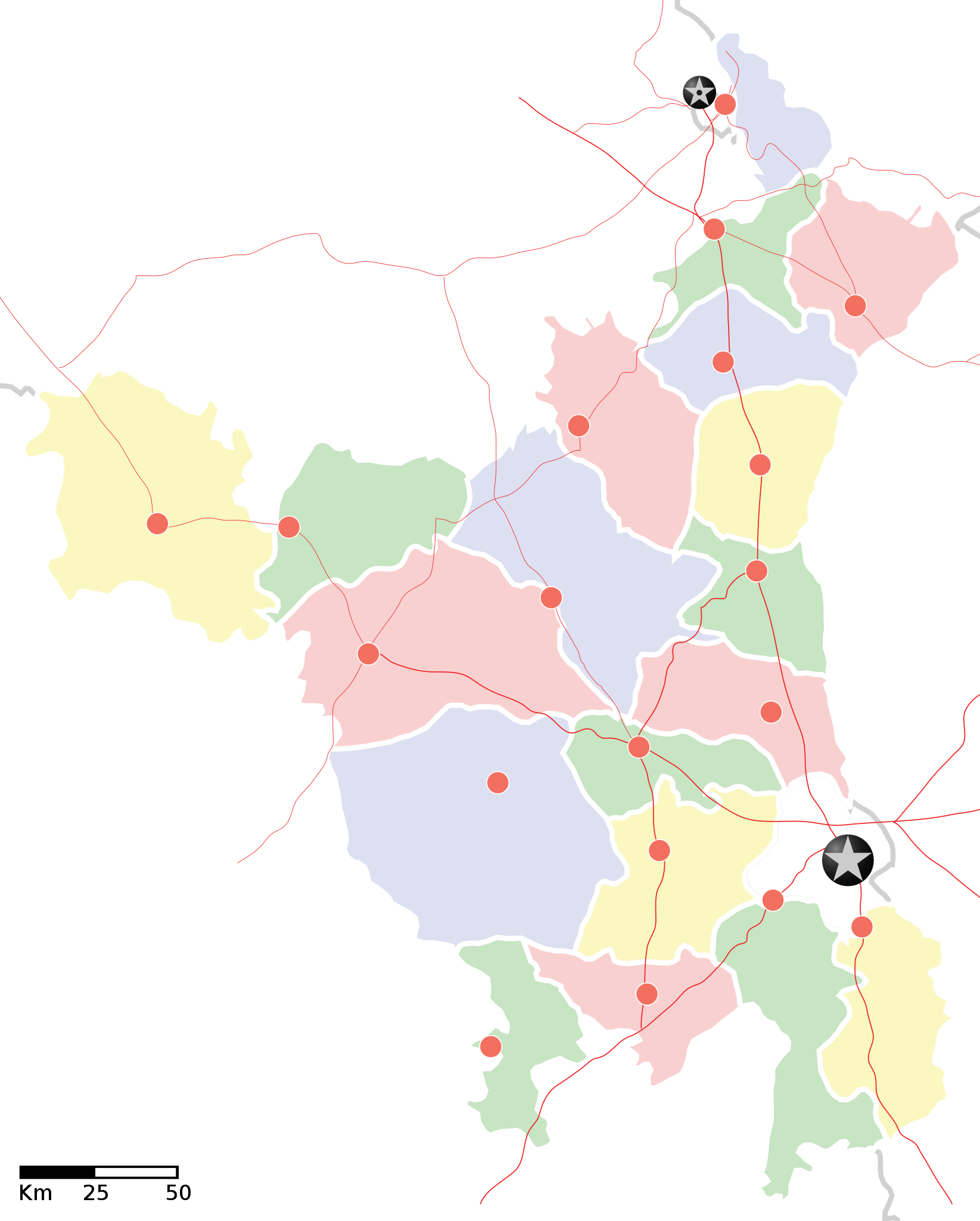
Haryana locator map |
||
| Description |
Locator map of the state of en:Haryana, India with district boundaries. Equirectangular projection. Geographic limits of the map: top=30.975 |
||
| تاریخ | |||
| قایناق |
یوکلهیهنین اؤز ایشی |
||
| پدیدآورنده |
|
||
| ایجازه (فایلین تکرار ایستیفادهسی) |
من، صاحب حقوق قانونی این اثر، به این وسیله این اثر را تحث اجازهنامهٔ ذیل منتشر میکنم: بو فایل کریتیو کامانز مجوز ایله Attribution-Share Alike 3.0 اویغونلاشمامیش یاییملانیبدیر.
|
||
| Geotemporal data | |||
| Date depicted | نیمهٔ دوم سدهٔ 20 و سدهٔ 21 | ||
| Georeferencing | If inappropriate please set warp_status = skip to hide. | ||
| Archival data | |||
| نوتلار | Part of WikiProject India Maps | ||
![[1]](http://maps.newkerala.com/Haryana-Travel-Map.jpg)
فايل گئچمیشی
فايلین اولکی وئرسیياسینی گؤرمک اۆچون گۆن/تاریخ بؤلمهسیندهکی تاریخلری تێقلايین.
| تاریخ/واخت | کیچیک عکس | اؤلچولر | ایشلدن | باخیش | |
|---|---|---|---|---|---|
| ایندیکی | ۹ سپتامبر ۲۰۰۸، ساعت ۱۷:۳۵ | | ۹۵۴ در ۱٬۱۸۸ (۸۳ کیلوبایت) | Planemad | {{Information |Description= |Source= |Date= |Author= |Permission= |other_versions= }} |
| ۹ سپتامبر ۲۰۰۸، ساعت ۱۷:۳۱ |  | ۹۵۴ در ۱٬۱۸۸ (۸۳ کیلوبایت) | Planemad | {{Information |Description={{en|1=a}} |Source=Own work by uploader |Author=PlaneMad |Date= |Permission= |other_versions= }} <!--{{ImageUpload|full}}--> |
فايل ایشلدمهسی
بو فایلا هئچ بیر صفحهیه باغلانماییب.
فایلین باشاباش ایشلنیلمهسی
بو فایل آشاغی داکی آیری ویکی لرده ایشلَنیر:
- ar.wikipedia.org-ده ایشلنمهسی
- as.wikipedia.org-ده ایشلنمهسی
- awa.wikipedia.org-ده ایشلنمهسی
- खाँचा:हरियाणा
- अम्बाला जिला
- करनाल जिला
- कर्ण झील
- कालका
- कुरुक्षेत्र जिला
- कैथल जिला
- गुड़गांव जिला
- गुरुग्राम
- चरखी दादरी
- तेलंगाना कय जिला
- पंचकुला
- पंचकूला
- पानीपत ज़िला
- पानीपत जिला
- पेहवा
- फरीदाबाद
- बड़खल झील
- मोरनी हिल्स
- रोहतक
- लोकसभा चुनाव क्षेत्रन कय सूची
- सोनीपत जिला
- हरियाणा विधानसभा
- हिसार
- खाँचा:तेलंगाना कय जिला
- खाँचा:हरियाणा कय लोकसभा चुनाव क्षेत्र
- खाँचा:हरियाणा कय विधानसभा चुनाव क्षेत्र
- ba.wikipedia.org-ده ایشلنمهسی
- bo.wikipedia.org-ده ایشلنمهسی
- ceb.wikipedia.org-ده ایشلنمهسی
- ckb.wikipedia.org-ده ایشلنمهسی
- de.wikipedia.org-ده ایشلنمهسی
- en.wikipedia.org-ده ایشلنمهسی
- es.wikipedia.org-ده ایشلنمهسی
- fa.wikipedia.org-ده ایشلنمهسی
- fi.wikipedia.org-ده ایشلنمهسی
- gu.wikipedia.org-ده ایشلنمهسی
بو فایلینسراسری ایستفاده لرینه باخین.