
فایل:Mount Baker hazard map-en.svg

حجم پیشنمایش PNG این SVG file:۸۰۰ × ۵۷۳ پیکسل آیری کیفیتلر: ۳۲۰ × ۲۲۹ پیکسل | ۶۴۰ × ۴۵۹ پیکسل | ۱٬۰۲۴ × ۷۳۴ پیکسل | ۱٬۲۸۰ × ۹۱۷ پیکسل | ۲٬۵۶۰ × ۱٬۸۳۴ پیکسل | ۴٬۷۱۲ × ۳٬۳۷۶ پیکسل.
فایلین اصلی (SVG فایلی، ۴٬۷۱۲ × ۳٬۳۷۶ پیکسئل، فایلین اؤلچوسو: ۴٫۲۴ مگابایت)
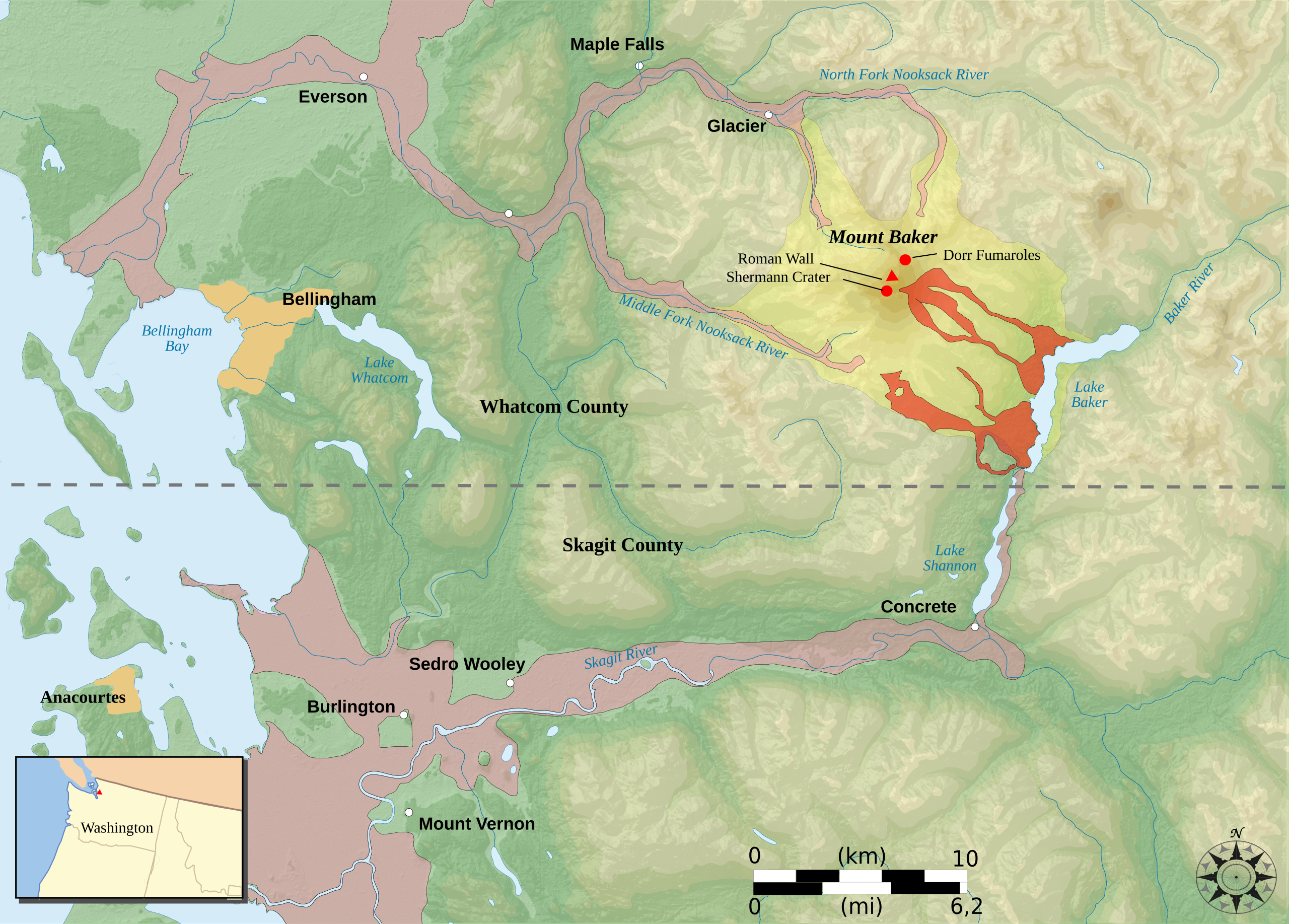
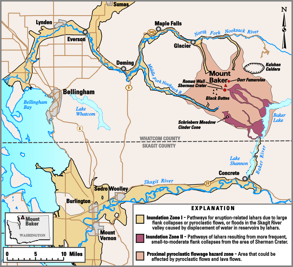
Picture keys
Inundation zone I : Pathways for eruption-related lahars due to large flanks collapses or pyroclastic flows, or floods in the Skagit River valley cause by displacement water in reservoirs by lahars
Inundation Zone II : Pathways of lahars resulting from more frequent, small-for-moderate flank collapses from the area of Sherman Crater.
Proximal pyroclastic flowage hazard zone : Area that could be affected by pyroclastic flows and lavas flows
Limites de comtés
قیساسی
| آچیقلاما |
English: Hazard map in english around the Mount Baker, state of Washington, United States.
Français : Carte en anglais des risques liés au volcanisme du Mont Baker, état de Washington, États-Unis. |
| تاریخ | |
| قایناق |
Own work.
Data sources :
Softwares used :
Others :
|
| یازار | Pinpin |
| آیری نوسخهلر |
|


|
This SVG file contains embedded text that can be translated into your language, using any capable SVG editor, text editor or the SVG Translate tool. For more information see: About translating SVG files. |
لیسانس
این تصویر در مالکیت عمومی است زیرا تنها پدیدآور آن سازمان زمینشناسی آمریکا است که یکی از سازمانهای وابسته به وزارت کشور ایالات متحده آمریکا به شمار میرود. برای اطلاعات بیشتر سیاستهای رسمی حق تکثیر سازمان زمینشناسی آمریکا را ببینید.
|
فايل گئچمیشی
فايلین اولکی وئرسیياسینی گؤرمک اۆچون گۆن/تاریخ بؤلمهسیندهکی تاریخلری تێقلايین.
| تاریخ/واخت | کیچیک عکس | اؤلچولر | ایشلدن | باخیش | |
|---|---|---|---|---|---|
| ایندیکی | ۱۱ فوریه ۲۰۰۸، ساعت ۱۹:۵۷ | | ۴٬۷۱۲ در ۳٬۳۷۶ (۴٫۲۴ مگابایت) | Pinpin | == Picture keys == {{legend|#ffc1d6|Inundation zone I : Pathways for eruption-related lahars due to large flanks collapses or pyroclastic flows, or floods in the Skagit River valley cause by displacement water in reservoirs by lahars}} {{legend|#f10000|I |
فايل ایشلدمهسی
آشاغیداکی صحیفه بو فایلا باغلانیر
فایلین باشاباش ایشلنیلمهسی
بو فایل آشاغی داکی آیری ویکی لرده ایشلَنیر:
- es.wikipedia.org-ده ایشلنمهسی