
فایل:Queens Road - geograph.org.uk - 212549.jpg
یوخاری کیفیت الده یوخدور.
Queens_Road_-_geograph.org.uk_-_212549.jpg (۶۴۰ × ۴۷۹ پیکسل, فایل اؤلچوسو: ۱۵۳ کیلوبایت, MIME نوعو: image/jpeg)
قیساسی
| آچیقلاما |
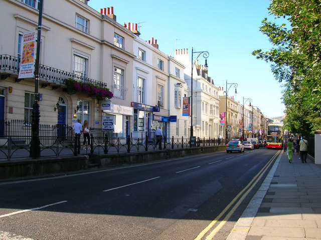
English: Queens Road. Taken from the junction of Church Street and Queens Road. Queens Road was constructed in 1845 to connect Brighton town centre with the newly opened Brighton station. Parts of the route were already occupied, to the south of this junction was Air Street a small slum area part of which still links Queens Road to Queens Square, whilst to the north was Windsor Terrace constructed in the 1830s. Unlike the slums Windsor Terrace still survives today as does the original walkway originally built next to a graveyard part of which survives to the right of the road today and is now a small park. The new road was built at a higher elevation than the old graveyard but lower than Windsor Terrace. The white building in the middle of the terrace is a Freemasons Lodge constructed in the 1920s.
Click on the link to take you to the next page. https://www.geograph.org.uk/photo/212550 |
| تاریخ | |
| قایناق | From geograph.org.uk |
| یازار | Simon Carey |
| موجَویز (required by the license) | Simon Carey / Queens Road / |
| مختصات دوربین | | محل قرارگیری این نگاره و سایر نگارهها در: نقشهٔ شهری باز |
|---|
_heading:45.00&language=azb)
| مختصات شیء | | محل قرارگیری این نگاره و سایر نگارهها در: نقشهٔ شهری باز |
|---|
_heading:45.00&language=azb)
لیسانس

|
این نگاره از مجموعهٔ پروژهٔ Geograph گرفته شدهاست. این صفحهٔ عکسها را در وبگاه Geograph برای جزئیات تماس با عکاس ببینید. حق تکثیر این تصویر به Simon Carey تعلق دارد و برای استفادهٔ مجدد تحت Creative Commons Attribution-ShareAlike 2.0 مجوزدهی شدهاست.
|
این پرونده با اجازهنامهٔ کریتیو کامانز Attribution-Share Alike 2.0 عمومی منتشر شده است.
موجَویز: Simon Carey
- سیزین ایجازه نیز وار دیر:
- بؤلۆشمک – اثرین کپی، پایلاشماق و چاتدیرماسی اوچون
- تلفیق ائت – اثرین توتوشدورماسی اوچون
- آشاغی داکی شرایطله:
- تخصیص – اثری مؤلف و یا لیسئنزییالی طرفیندن گؤستریلدیی کیمی ایستیناد ائتملیسینیز (آنجاق سنی دستکلدیینی و یا اثردن ایستیفاده ائتمیینیزی تکلیف ائتمملیسینیز).
- بیرگه پایلاشیم – اگر بو اثرده دَییشدیرمه، چؤندرمه، یا دا کؤکدن دوزلتمه ائتسز، اله گلمیش اثری یالنیز بیر ائشیت یوخسا اوخشار بیر مجوزین آلتیندا یاییملایابیلرسینیز .
فايل گئچمیشی
فايلین اولکی وئرسیياسینی گؤرمک اۆچون گۆن/تاریخ بؤلمهسیندهکی تاریخلری تێقلايین.
| تاریخ/واخت | کیچیک عکس | اؤلچولر | ایشلدن | باخیش | |
|---|---|---|---|---|---|
| ایندیکی | ۱ فوریه ۲۰۱۰، ساعت ۰۰:۰۲ | | ۶۴۰ در ۴۷۹ (۱۵۳ کیلوبایت) | GeographBot | == {{int:filedesc}} == {{Information |description={{en|1=Queens Road. Taken from the junction of Church Street and Queens Road. Queens Road was constructed in 1845 to connect Brighton town centre with the newly opened Brighton station. Parts of the route |
فايل ایشلدمهسی
آشاغیداکی صحیفه بو فایلا باغلانیر
فایلین باشاباش ایشلنیلمهسی
بو فایل آشاغی داکی آیری ویکی لرده ایشلَنیر:
- en.wikipedia.org-ده ایشلنمهسی
- sl.wikipedia.org-ده ایشلنمهسی
- szl.wikipedia.org-ده ایشلنمهسی