
فایل:Village Hall at Jacobs Well - geograph.org.uk - 52889.jpg
یوخاری کیفیت الده یوخدور.
Village_Hall_at_Jacobs_Well_-_geograph.org.uk_-_52889.jpg (۶۴۰ × ۴۲۷ پیکسل, فایل اؤلچوسو: ۷۲ کیلوبایت, MIME نوعو: image/jpeg)
قیساسی
| آچیقلاما |
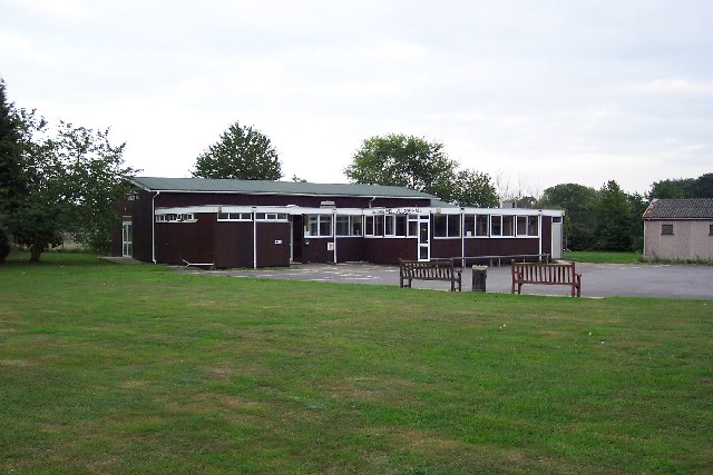
English: Village Hall at Jacobs Well. Jacobs Well was originally a small settlement around the junction of Clay Lane and the road to Sutton Green, not far from the River Wey. Today suburban bungalows and cul-de-sacs have sprung up and it is virtually on the outskirts of Guildford. In the fields close to the village can be seen the remains of a remarkable irrigation system developed by Sir Richard Weston in the first half of the 17th century. This led to the construction of the Wey Navigation, which is now owned by the National Trust. |
| تاریخ | |
| قایناق | From geograph.org.uk |
| یازار | Ron Strutt |
| موجَویز (required by the license) | Ron Strutt / Village Hall at Jacobs Well / |
| مختصات شیء | | محل قرارگیری این نگاره و سایر نگارهها در: نقشهٔ شهری باز |
|---|
_&language=azb)
لیسانس

|
این نگاره از مجموعهٔ پروژهٔ Geograph گرفته شدهاست. این صفحهٔ عکسها را در وبگاه Geograph برای جزئیات تماس با عکاس ببینید. حق تکثیر این تصویر به Ron Strutt تعلق دارد و برای استفادهٔ مجدد تحت Creative Commons Attribution-ShareAlike 2.0 مجوزدهی شدهاست.
|
این پرونده با اجازهنامهٔ کریتیو کامانز Attribution-Share Alike 2.0 عمومی منتشر شده است.
موجَویز: Ron Strutt
- سیزین ایجازه نیز وار دیر:
- بؤلۆشمک – اثرین کپی، پایلاشماق و چاتدیرماسی اوچون
- تلفیق ائت – اثرین توتوشدورماسی اوچون
- آشاغی داکی شرایطله:
- تخصیص – اثری مؤلف و یا لیسئنزییالی طرفیندن گؤستریلدیی کیمی ایستیناد ائتملیسینیز (آنجاق سنی دستکلدیینی و یا اثردن ایستیفاده ائتمیینیزی تکلیف ائتمملیسینیز).
- بیرگه پایلاشیم – اگر بو اثرده دَییشدیرمه، چؤندرمه، یا دا کؤکدن دوزلتمه ائتسز، اله گلمیش اثری یالنیز بیر ائشیت یوخسا اوخشار بیر مجوزین آلتیندا یاییملایابیلرسینیز .
فايل گئچمیشی
فايلین اولکی وئرسیياسینی گؤرمک اۆچون گۆن/تاریخ بؤلمهسیندهکی تاریخلری تێقلايین.
| تاریخ/واخت | کیچیک عکس | اؤلچولر | ایشلدن | باخیش | |
|---|---|---|---|---|---|
| ایندیکی | ۳۰ ژانویه ۲۰۱۰، ساعت ۲۰:۴۴ | | ۶۴۰ در ۴۲۷ (۷۲ کیلوبایت) | GeographBot | == {{int:filedesc}} == {{Information |description={{en|1=Village Hall at Jacobs Well. Jacobs Well was originally a small settlement around the junction of Clay Lane and the road to Sutton Green, not far from the River Wey. Today suburban bungalows and cul |
فايل ایشلدمهسی
آشاغیداکی صحیفه بو فایلا باغلانیر
فایلین باشاباش ایشلنیلمهسی
بو فایل آشاغی داکی آیری ویکی لرده ایشلَنیر:
- en.wikipedia.org-ده ایشلنمهسی
- fa.wikipedia.org-ده ایشلنمهسی
- pl.wikipedia.org-ده ایشلنمهسی
- sv.wikipedia.org-ده ایشلنمهسی
- www.wikidata.org-ده ایشلنمهسی