
فایل:Virginia Frederick Stephens City.png

سیناق گؤستریشی اؤلچوسو: ۷۴۳ × ۶۰۰ پیکسل. آیری کیفیتلر: ۲۹۷ × ۲۴۰ پیکسل | ۵۹۵ × ۴۸۰ پیکسل | ۸۲۰ × ۶۶۲ پیکسل.
فایلین اصلی (۸۲۰ × ۶۶۲ پیکسل, فایل اؤلچوسو: ۱۳۳ کیلوبایت, MIME نوعو: image/png)
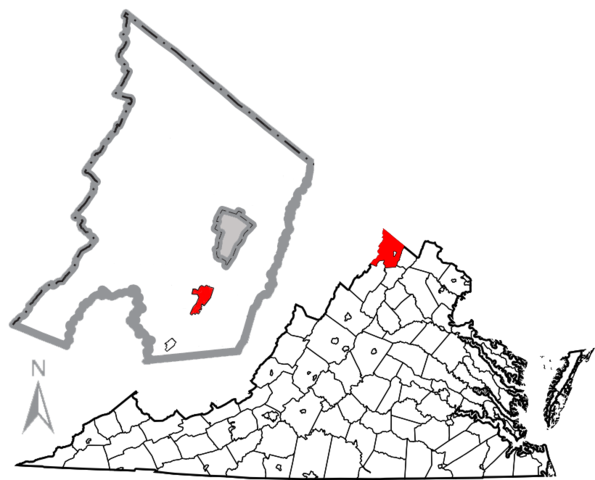
| آچیقلاما | Combination map of Virginia showing Frederick County, originally created by David Benbennick with a map of Frederick County and the town of Stephens City highlighted in red, created by User:JonRidinger. The gray are in the middle of the Frederick County map is the independent city of Winchester. |
| تاریخ | (UTC) |
| قایناق | |
| یازار |
|
| این یک عکس دستکاری شده است به این معنی که به صورت دیجیتالی از نسخهٔ اصلی تغییر یافتهاست. تغییرها: Combined maps, moved compass, removed distance scale. اصل آن را میتوان در اینجا مشاهده کرد: Map of Virginia highlighting Frederick County.svg. تغییرها توسط JonRidinger انجام شدهاست.
|
این پرونده با اجازهنامهٔ کریتیو کامانز Attribution 3.0 بومی نشده منتشر شده است.
- سیزین ایجازه نیز وار دیر:
- بؤلۆشمک – اثرین کپی، پایلاشماق و چاتدیرماسی اوچون
- تلفیق ائت – اثرین توتوشدورماسی اوچون
- آشاغی داکی شرایطله:
- تخصیص – اثری مؤلف و یا لیسئنزییالی طرفیندن گؤستریلدیی کیمی ایستیناد ائتملیسینیز (آنجاق سنی دستکلدیینی و یا اثردن ایستیفاده ائتمیینیزی تکلیف ائتمملیسینیز).
اورجینال یوکلمه گوندهلیگی
This image is a derivative work of the following images:
- File:Frederick_Stephens_City.png licensed with Cc-by-sa-2.5, Cc-by-sa-3.0-migrated, GFDL, PD-USGov-DOC-Census
- 2010-05-03T03:36:57Z JonRidinger 424x555 (45971 Bytes) Updated boundaries of Stephens City and Middletown using 2010 Boundary and Annexation Survey from [http://www2.census.gov/geo/www/bas/st51_va/cou/c51069_frederick/BAS10C25106900000_000.pdf here]
- 2010-05-02T21:59:28Z JonRidinger 424x555 (45027 Bytes) Minor change in scale
- 2010-05-02T21:52:28Z JonRidinger 424x555 (44965 Bytes) Cleaned up, removed magisterial district borders. [[Category:Maps of Frederick County, Virginia]]
- 2010-05-01T07:03:19Z JonRidinger 424x555 (53079 Bytes) {{Information |Description=Map of Frederick County, Virginia, United States showing [[w:Stephens City, Virginia]]. |Source=*[[:File:Map_of_Frederick_County,_Virginia_with_Municipal_and_District_Labels.png|]] |Date=2010-05-01
- File:Map_of_Virginia_highlighting_Frederick_County.svg licensed with PD-self
- 2006-02-12T17:45:24Z David Benbennick 7486x3247 (228780 Bytes) {{subst:User:Dbenbenn/clm|county=Frederick County|state=Virginia|type=county}}
Uploaded with derivativeFX
فايل گئچمیشی
فايلین اولکی وئرسیياسینی گؤرمک اۆچون گۆن/تاریخ بؤلمهسیندهکی تاریخلری تێقلايین.
| تاریخ/واخت | کیچیک عکس | اؤلچولر | ایشلدن | باخیش | |
|---|---|---|---|---|---|
| ایندیکی | ۷ مئی ۲۰۱۰، ساعت ۱۶:۳۲ | | ۸۲۰ در ۶۶۲ (۱۳۳ کیلوبایت) | JonRidinger | {{Information |Description=Combination map of Virginia showing Frederick County, originally created by David Benbennick with a map of Frederick County and the town of [[w:Stephens City, Vi |
فايل ایشلدمهسی
آشاغیداکی صحیفه بو فایلا باغلانیر
فایلین باشاباش ایشلنیلمهسی
بو فایل آشاغی داکی آیری ویکی لرده ایشلَنیر:
- en.wikipedia.org-ده ایشلنمهسی
- fr.wikipedia.org-ده ایشلنمهسی
- it.wikipedia.org-ده ایشلنمهسی
- ja.wikipedia.org-ده ایشلنمهسی
- sh.wikipedia.org-ده ایشلنمهسی
- simple.wikipedia.org-ده ایشلنمهسی