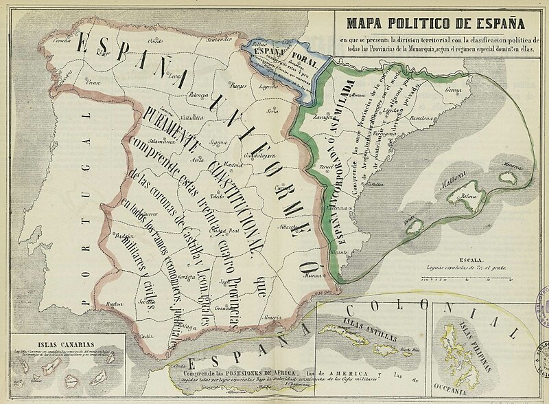
فایل:Mapa político de España, 1850.jpg
ظاهر

سیناق گؤستریشی اؤلچوسو: ۸۰۰ × ۵۸۸ پیکسل. آیری کیفیتلر: ۳۲۰ × ۲۳۵ پیکسل | ۶۴۰ × ۴۷۰ پیکسل | ۱٬۰۲۴ × ۷۵۲ پیکسل | ۱٬۲۸۰ × ۹۴۰ پیکسل | ۱٬۸۰۰ × ۱٬۳۲۲ پیکسل.
فایلین اصلی (۱٬۸۰۰ × ۱٬۳۲۲ پیکسل, فایل اؤلچوسو: ۳۹۹ کیلوبایت, MIME نوعو: image/jpeg)
فايل گئچمیشی
فايلین اولکی وئرسیياسینی گؤرمک اۆچون گۆن/تاریخ بؤلمهسیندهکی تاریخلری تێقلايین.
| تاریخ/واخت | کیچیک عکس | اؤلچولر | ایشلدن | باخیش | |
|---|---|---|---|---|---|
| ایندیکی | ۲۳ نوْوامبر ۲۰۱۲، ساعت ۱۰:۵۲ |  | ۱٬۸۰۰ در ۱٬۳۲۲ (۳۹۹ کیلوبایت) | Ivan bea | Better resolution image of the same file |
| ۴ آقوست ۲۰۰۶، ساعت ۱۶:۲۳ |  | ۸۰۰ در ۵۹۵ (۹۸ کیلوبایت) | Dodo | Political map of Spain in 1854 after the First Carlist War and the tax, legal system and military frontiers move to the Pyrenees, which resulted in the spreading of a sense of frustration among the Basques that led to another Carlist war and the subsequen |
فايل ایشلدمهسی
آشاغیداکی صحیفه بو فایلا باغلانیر
فایلین باشاباش ایشلنیلمهسی
بو فایل آشاغی داکی آیری ویکی لرده ایشلَنیر:
- an.wikipedia.org-ده ایشلنمهسی
- ar.wikipedia.org-ده ایشلنمهسی
- ca.wikipedia.org-ده ایشلنمهسی
- Espanya
- Història del País Valencià
- Corona d'Aragó
- Furs
- Espanyolisme
- Diada Nacional de Catalunya
- Anticatalanisme
- Història del dret català
- Nacionalitat històrica
- Cronologia de la repressió del català
- Sexenni Democràtic
- Història del nacionalisme basc
- Diada del 25 d'abril
- Estat nació
- Història de l'Aragó
- Regionalisme i nacionalisme a Espanya
- Història del País Basc
- Usuari:Coentor/25
- Història de l'organització territorial del poder a Espanya
- de.wikipedia.org-ده ایشلنمهسی
- en.wikipedia.org-ده ایشلنمهسی
- Catalan language
- History of Europe
- Nation state
- History of Catalonia
- Fuero
- Catalan independence movement
- First Carlist War
- User:Idiazabal
- Anti-Catalan sentiment
- History of the Basques
- 1833 territorial division of Spain
- Communities of chartered regime
- End of Basque home rule in Spain
- User:Ixtal/sandbox
- History of the territorial organization of Spain
- eo.wikipedia.org-ده ایشلنمهسی
- es.wikipedia.org-ده ایشلنمهسی
- Vasco
- Corona de Aragón
- Fuero
- Historia de la organización territorial de España
- Régimen foral
- Formación territorial de España
- Discusión:Corona de Castilla
- Historia del País Vasco
- Historia del nacionalismo vasco
- Proyecto político de Euskal Herria
- Ley de 21 de julio de 1876
- Ley de Confirmación de Fueros de 1839
بو فایلینسراسری ایستفاده لرینه باخین.
