اش ویل
ظاهر
| اش ویل | |
|---|---|
 The Basingstoke Canal Aqueduct/Viaduct over the Blackwater has an adjoining footpath lined with mature gorse and heather, endemic to the south and east of the area. | |
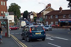
 Local shops at a busy crossroads, near Ash Wharf on the canal. The village is part of the technology-focussed Blackwater Valley Conurbation. | |
| Area | ۳٫۶۲ km2 (۱٫۴۰ sq mi) |
| جمعیت | ۵٬۶۸۶ (2011 census)[۱] |
| • Density | ۱٬۵۷۱/km2 (۴٬۰۷۰/sq mi) |
| OS grid reference | SU891524 |
| Civil parish | |
| District | |
| Shire county | |
| Region | |
| اؤلکه | England |
| موستقیل دوولت | United Kingdom |
| Post town | الدرشات |
| Postcode district | GU12 |
| تیلفون کودو | 01252 |
| UK Parliament | |
اش ویل (اینگیلیسیجه: Ash Vale) بریتانیادا بیر یاشاییش منطقهسیدیر سوْن نۆفوس تخمینلرینه گؤره 5686 نفر دیر. بۇ شهر اینگیلیس اؤلکهسینده یئرلشیب.
- ^ Key Statistics: Population; Quick Statistics: Economic indicators. (2011 census and 2001 census) Retrieved 27 February 2015.

