اوکهام، ساری
ظاهر
| Ockham | |
|---|---|
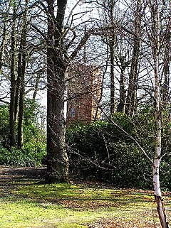
 The Semaphore Tower rises from high Ockham and Wisley Commons at Chatley Heath. These are separated from the formal landscape of Painshill Park by the M25 motorway. | |
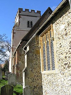
 All Saints (in the Church of England). Most of the Grade I architecturally listed church (in different sections) spans the middle of the اورتا عصرلر. | |
| Area | ۱۲٫۱۳ km2 (۴٫۶۸ sq mi) |
| جمعیت | ۴۱۰ (civil parish, 2011)[۱] |
| • Density | ۳۴/km2 (۸۸/sq mi) |
| OS grid reference | TQ0756 |
| District | |
| Shire county | |
| Region | |
| اؤلکه | England |
| موستقیل دوولت | United Kingdom |
| Post town | WOKING |
| Postcode district | GU23 |
| تیلفون کودو | 01483 |
| UK Parliament | |
اوکهام، ساری (اینگیلیسیجه: Ockham, Surrey) بریتانیادا بیر یاشاییش منطقهسیدیر سوْن نۆفوس تخمینلرینه گؤره 410 نفر دیر. بۇ شهر اینگیلیس اؤلکهسینده یئرلشیب.
- ^ Ockham (Parish): Key Figures for 2011 Census. Neighbourhood Statistics. Office for National Statistics. آرشیولنیب اصلی نۆسخهدن on 2017-04-24. یوْخلانیلیب21 November 2013.

