ماژول:Location map/data/Italy
| بو لوآ ماژول تخمینا ۹٬۹۰۰ صفحهده ایشلنیب و دییشیکلیکلر گئنیش شکلیده موشاهیده اولونا بیلر. تست اوچون ماژول-ون /قارالاما یا /تست صفحهلرینده سیناقدان کئچیرین، یادا اوزوزون module sandbox یارادین. دییشیکلیکلرین بارهسینده دانیشیق صفحهسینده دانیشین سونرا دییشیکلیکلری ایجرا ائدین. |
| آدی | Italy | |||
|---|---|---|---|---|
| border coordinates | ||||
| 47.4 | ||||
| 6.2 | ←↕→ | 19 | ||
| 35.3 | ||||
| map center | 41°21′N 12°36′E / 41.35°N 12.6°E | |||
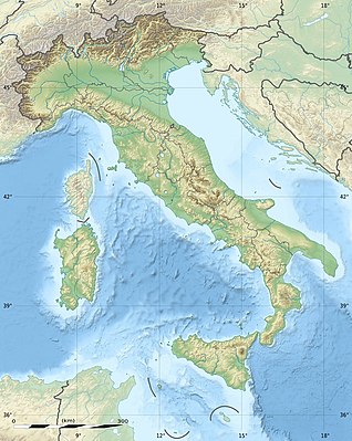
| عکس | Italy provincial location map 2016.svg
| |||

| ||||
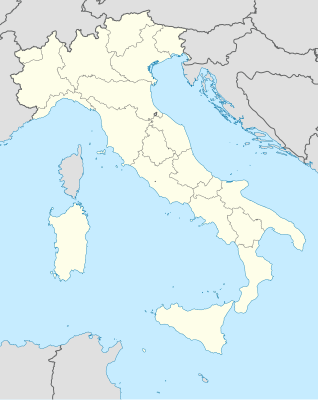
| عکس1 | Italy relief location map.jpg
| |||

| ||||
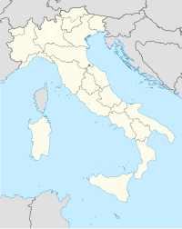
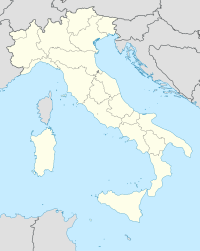
| عکس2 | Italy location map.svg
| |||

| ||||

ماژول:Location map/data/Italy is a location map definition used to overlay markers and labels on an equirectangular projection map of Italy. The markers are placed by ائنلم and longitude coordinates on the default map or a similar map image.
ایستیفادهسی
بو تعریفلر «Italy» پارامتری ایله چاغیریلدیقدا آشاغیداکی شابلونلار طرفیندن ایستیفاده اوْلونور:
{{Location map|Italy |...}}{{Location map many|Italy |...}}{{Location map+|Italy |...}}{{Location map~|Italy |...}}
نقشه تعریفلری
name = Italy- دیفالت نقشه باشلیغیندا ایستیفاده ائدیلن آد
image = Italy provincial location map 2016.svg- The default map image, without "Image:" or "File:"
image1 = Italy relief location map.jpg- An alternative map image, usually a relief map, which can be displayed via the relief or AlternativeMap parameters
image2 = Italy location map.svg- Alternative map image which can be displayed via the AlternativeMap parameter
top = 47.4- ائنلم at top edge of map, in decimal degrees
bottom = 35.3- Latitude at bottom edge of map, in decimal degrees
left = 6.2- Longitude at left edge of map, in decimal degrees
right = 19- Longitude at right edge of map, in decimal degrees
آلترناتیو نقشه
The {{Location map}}, {{Location map many}}, and {{Location map+}} templates have parameters to specify an alternative map image. The map displayed as image1 can be used with the relief or AlternativeMap parameters. The map displayed as image2 can be used with the AlternativeMap parameter. Examples may be found below or in the following:
- شابلون:Location map
- Template:Location map+/relief
- شابلون:Location map
- Template:Location map+/AlternativeMap
دقیقلیک
Longitude: from West to East this map definition covers 12.8 degrees.
- At an image width of 200 pixels, that is 0.064 degrees per pixel.
- At an image width of 1000 pixels, that is 0.0128 degrees per pixel.
ائنلم: from North to South this map definition covers 12.1 degrees.
- At an image height of 200 pixels, that is 0.0605 degrees per pixel.
- At an image height of 1000 pixels, that is 0.0121 degrees per pixel.
یئر نقشهسی شابلونلاریندان ایستیفاده نۆمونهلری
Location map, using default map (image)
{{Location map| Italy
| width   = 200
| lat_deg = 41.9
| lon_deg = 12.5
| label   = Rome
}}
Location map many, using relief map (image1)
{{Location map many| Italy
| relief   = yes
| width    = 200
| caption  = Two locations in Italy
| lat1_deg = 41.9
| lon1_deg = 12.5
| label1   = Rome
| lat2_deg = 40.35
| lon2_deg = 18.17
| label2   = Lecce
}}
Location map+, using AlternativeMap
{{Location map+| Italy
| AlternativeMap = Italy location map.svg
| width   = 200
| caption = Two locations in Italy
| places  =
  {{Location map~| Italy
  | lat_deg = 41.9
  | lon_deg = 12.5
  | label   = Rome
  }}
  {{Location map~| Italy
  | lat_deg = 40.35
  | lon_deg = 18.17
  | label   = Lecce
  }}
}}
همچینین باخ
یئر نقشهسینین شابلونلاری
- شابلون:Location map, to display one mark and label using latitude and longitude
- شابلون:Location map many, to display up to nine marks and labels
- شابلون:Location map+, to display an unlimited number of marks and labels
یئنی نقشه تعریفلرینین یارادماسی


