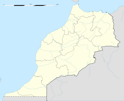
ماژول:Location map/data/Morocco
| آدی | Morocco | |||
|---|---|---|---|---|
| border coordinates | ||||
| 36.25 | ||||
| -13.55 | ←↕→ | -0.6 | ||
| 27.3 | ||||
| map center | 31°46′30″N 7°04′30″W / 31.775°N 7.075°W | |||
| عکس | Morocco location map.svg
| |||

| ||||
| عکس1 | Morocco relief location map.jpg
| |||

| ||||
ماژول:Location map/data/Morocco is a location map definition used to overlay markers and labels on an equirectangular projection map of Morocco. The markers are placed by ائنلم and longitude coordinates on the default map or a similar map image.
ایستیفادهسی
بو تعریفلر «Morocco» پارامتری ایله چاغیریلدیقدا آشاغیداکی شابلونلار طرفیندن ایستیفاده اوْلونور:
{{Location map|Morocco |...}}{{Location map many|Morocco |...}}{{Location map+|Morocco |...}}{{Location map~|Morocco |...}}
نقشه تعریفلری
name = Morocco- دیفالت نقشه باشلیغیندا ایستیفاده ائدیلن آد
image = Morocco location map.svg- The default map image, without "Image:" or "File:"
image1 = Morocco relief location map.jpg- An alternative map image, usually a relief map, which can be displayed via the relief or AlternativeMap parameters
top = 36.25- ائنلم at top edge of map, in decimal degrees
bottom = 27.3- Latitude at bottom edge of map, in decimal degrees
left = -13.55- Longitude at left edge of map, in decimal degrees
right = -0.6- Longitude at right edge of map, in decimal degrees
آلترناتیو نقشه
The {{Location map}}, {{Location map many}}, and {{Location map+}} templates have parameters to specify an alternative map image. The map displayed as image1 can be used with the relief or AlternativeMap parameters. Examples may be found below or in the following:
- شابلون:Location map
- Template:Location map+/relief
- شابلون:Location map
- Template:Location map+/AlternativeMap
دقیقلیک
Longitude: from West to East this map definition covers 12.95 degrees.
- At an image width of 200 pixels, that is 0.0648 degrees per pixel.
- At an image width of 1000 pixels, that is 0.013 degrees per pixel.
ائنلم: from North to South this map definition covers 8.95 degrees.
- At an image height of 200 pixels, that is 0.0448 degrees per pixel.
- At an image height of 1000 pixels, that is 0.009 degrees per pixel.
همچینین باخ
یئر نقشهسینین شابلونلاری
- شابلون:Location map, to display one mark and label using latitude and longitude
- شابلون:Location map many, to display up to nine marks and labels
- شابلون:Location map+, to display an unlimited number of marks and labels
