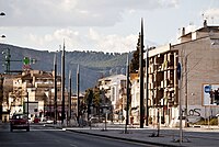
البولوت
Albolote | |
|---|---|
City | |
 Location of Albolote | |
| موختصاتلار: 37°13′50″N 3°39′25″W / 37.23056°N 3.65694°Wموختصات: 37°13′50″N 3°39′25″W / 37.23056°N 3.65694°W | |
| دۆنیا اؤلکهلری | ایسپانیا |
| Comarca | Vega de Granada |
| Municipality | Albolote |
| اراضی | |
| • جمع | ۷۹ km2 (۳۱ sq mi) |
| اوجالیق | ۶۵۵ m (۲٬۱۴۹ ft) |
| جمعیت (2005) | |
| • جمع | ۱۵٬۵۶۳ |
| • سیخلیق | ۱۹۷٫۰/km2 (۵۱۰/sq mi) |
| ساعات قورشاغی | یوتیسی +1 (CET) |
| • یای (DST) | یوتیسی +2 (CEST) |
| وئب سایت | http://www.albolote.org/portal/ |
البولوت (ایسپانجا: Alguazas) Albolote ایسپانیادا بیر یاشاییش منطقهسیدیر بۇ شهرین مساحتی ۷۹ کیلومتر موربّع دیر. ۶۵۵ متر دنیز سویهسیندن اۇجالیقی وار. سوْن نۆفوس تخمینلرینه گؤره ۱۵۵۶۳ نفر دیر. اهالی سیخلیغی ۱۹۷ اینسان کیلومتر موربّع دیر.
گؤرونتولر
[دَییشدیر]بیرده باخ
[دَییشدیر]قایناقلار
[دَییشدیر]ایسپانیا ویکیپدیاسینین ایشلدنلری طرفیندن یارانمیش«Albolote»، مقالهسیندن گؤتورولوبدور.( ۷ مارس ۲۰۱۸ تاریخینده یوْخلانیلیبدیر).
| بو شهرلر ایله باغلی مقاله، بیر قارالاما مقاله دیر. بونو گئنیشلندیرمکله ویکیپدیایا کؤمک ائده بیلرسینیز. |
Climate
[دَییشدیر]Albolote enjoys a mediterranean climate: fresh winters and hot summers. There's a great thermic oscillation varying up to 20 °C in a single day. Most of the rain falls during winter, meaning it scarcely rains throughout the summer.
| Climatic parameters in Albolote | |||||||||||||
|---|---|---|---|---|---|---|---|---|---|---|---|---|---|
| Month | Jan | Feb | Mar | April | May | Jun | Jul | Aug | Sep | Oct | Nov | Dec | Annual |
| Maximum temperature (°C) | 13.0 | 15.3 | 18.6 | 20.1 | 24.6 | 30.0 | 34.4 | 33.9 | 29.4 | 22.7 | 17.2 | 13.5 | 22.7 |
| Average temperature (°C) | 6.7 | 8.5 | 11.0 | 12.8 | 16.8 | 21.4 | 24.8 | 24.5 | 20.9 | 15.5 | 10.7 | 7.6 | 15.1 |
| Average minimum temperature | 0.3 | 1.8 | 3.4 | 5.6 | 9.0 | 12.9 | 15.2 | 15.0 | 12.4 | 8.2 | 4.2 | 1.8 | 7.5 |
| Total precipitations (mm) | 41 | 38 | 30 | 38 | 28 | 17 | 4 | 3 | 16 | 42 | 48 | 53 | 357 |
| Font: Metereological State Agency of Spain | |||||||||||||
Demography
[دَییشدیر]According to the Instituto Nacional de Estadística de España, in the year 2014 Albolote had 18,306 inhabitants.
| Town Hall Albolote 2015 | |||
|---|---|---|---|
| Politic Group | Votos | %Valid | Charges obtained |
| Partido Popular (PP) | 2.623 | 29,60% | 6 |
| Partido Socialista Obrero Español (PSOE) | 2.3363 | 26,67% | 5 |
| Izquierda Unida- Ganemos Albolote para la Gente (PG) | 1.530 | 17,27% | 3 |
| Ciudadanos- Partido de la ciudadanía (C's) | 1.160 | 13,09% | 2 |
| Agrupación Electoral Ganar Albolote (GA) | 709 | 8% | 1 |
| Identificator | Denomination | Itinerary |
|---|---|---|
| A-44 | Autovía
de Sierra Nevada |
Bailén - Motril |
| GR-30 | Segunda
circunvalación de Granada |
Albolote - Alhendín |
| A-92 | Autovía A-92 | Sevilla - Almería |
| N-323a | Carretera de Sierra Nevada | Bailén - Motril |
| A-4076 | 'Carretera de Colomera' | Parque del Cubillas -Colomera |
| GR-3417 | 'De Maracena a Santa Fe por'
Albolote y Atarfe5' |
Maracena - Santa Fe |
| GR-3419 | 'De A-44 a GR-3424'5 | El
Chaparral -Güevéjar |
| GR-3423 | De A-44 a Iznalloz5 | Deifontes - Iznalloz |
| Generic Denomination | 'Name' | 'Nature' | 'Address' |
|---|---|---|---|
| Education center for adults | S.E.P. "Albolut" | Public | Doctor Burgos Canals, 6 |
| Education center for adults | C.E.P. "Concepción Arenal" | Public | Ctra. de Colomera km. 16,5 |
| Private educational institute | Colegio "Ave María" | Private | Jacobo Camarero, 3 |
| Private pre-school education center | E.I. "Anaki" | Private | Baza, parcela 345. P.I. Juncaril |
| Private pre-school education center | E.I. "Galopín" | Private | Fray Bartolomé de las Casas, 4 |
| Private pre-school education center | E.I. "Loma Verde" | Private | Av. de las Acacias, s/n. Urbanización Loma Verde |
| Private pre-school education center | E.I. "Nenes" | Private | Doctor Laureano Vázquez, 4, locales 7 y 8 |
| Primary school | C.E.I.P. "Abadía" | Public | Abadía, 36 |
| Primary school | C.E.I.P. "San Isidro Labrador" | Public | Av. de las Acacias, s/n. El Chaparral |
| Primary school | C.E.I.P. "Tínar" | Public | Tínar, 46 |
| Pre-school | E.I. "El Parque" | Public | Doctor Burgos Canals, s/n |
| Pre-school | E.I. "Francisco Lucilo de Carvajal" | Public | Doctor Burgos Canals, 8 |
| Secondary Education institute | I.E.S. "Aricel" | Public | Aricel, s/n |


