اوناقا، کانزاس
ظاهر
Onaga, Kansas | |
|---|---|
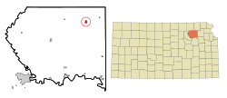
 Location within Pottawatomie County and Kansas | |
 | |
| موختصاتلار: 39°29′22″N 96°10′8″W / 39.48944°N 96.16889°Wموختصات: 39°29′22″N 96°10′8″W / 39.48944°N 96.16889°W | |
| Country | United States |
| State | Kansas |
| County | Pottawatomie |
| Platted | 1877 |
| Incorporated | 1926 |
| اراضی | |
| • جمع | ۰٫۶۴ sq mi (۱٫۶۶ km2) |
| • توپراق | ۰٫۶۴ sq mi (۱٫۶۶ km2) |
| • سو | ۰ sq mi (۰ km2) |
| اوجالیق | ۱٬۱۰۲ ft (۳۳۶ m) |
| جمعیت (2010) | |
| • جمع | ۷۰۲ |
| • تخمین (2018) | ۶۹۰ |
| • سیخلیق | ۱٬۱۰۰/sq mi (۴۲۰/km2) |
| ساعات قورشاغی | یوتیسی -6 (CST) |
| • یای (DST) | یوتیسی -5 (CDT) |
| ZIP code | 66521 |
| Area code | 785 |
| FIPS code | 20-52875 [۱] |
| GNIS ID | 0476116 [۲] |
| وئب سایت | cityofonaga.com |
اوناقا (اینگیلیسجه: Onaga, Kansas) آمریکانین کانزاس ایالتینده یئرلشن بیر کند. ۲۰۱۸-جی وئریلن معلوماتا اهالیسینین سایی ۶۹۰ نفر ایدی.
قایناقلار
[دَییشدیر]- ^ American FactFinder. United States Census Bureau. یوْخلانیلیب2008-01-31.
- ^ US Board on Geographic Names. United States Geological Survey (2007-10-25). یوْخلانیلیب2008-01-31.
