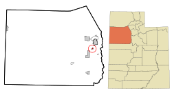
ایستوکتون، یوتا
ظاهر
Stockton, Utah | |
|---|---|
 Location in Tooele County and the state of Utah | |
 Location of Utah in the United States | |
| موختصاتلار: 40°27′4″N 112°21′43″W / 40.45111°N 112.36194°Wموختصات: 40°27′4″N 112°21′43″W / 40.45111°N 112.36194°W | |
| Country | United States |
| State | Utah |
| County | Tooele |
| Settled | 1863[۱] |
| Incorporated | 1901 |
| آدلاندیرما سببی | Stockton, California[۲] |
| ایداره | |
| • نووع | Mayor/Council |
| • Mayor | Thomas Karjola |
| اراضی | |
| • جمع | ۱٫۶۹ sq mi (۴٫۳۸ km2) |
| • توپراق | ۱٫۶۸ sq mi (۴٫۳۶ km2) |
| • سو | ۰٫۰۱ sq mi (۰٫۰۲ km2) |
| اوجالیق | ۵٬۱۱۸ ft (۱٬۵۶۰ m) |
| جمعیت (2010) | |
| • جمع | ۶۱۶ |
| • تخمین (2018) | ۶۸۴ |
| • سیخلیق | ۴۰۶٫۴۲/sq mi (۱۵۶٫۹۲/km2) |
| ساعات قورشاغی | یوتیسی -7 (Mountain (MST)) |
| • یای (DST) | یوتیسی -6 (MDT) |
| ZIP code | 84071 |
| تیلفون کودلاری | 435 |
| FIPS code | 49-73050[۴] |
| GNIS feature ID | 1432990[۵] |
| وئب سایت | www.stocktontown.org |
ایستوکتون (اینگیلیسجه: Stockton, Utah) آمریکانین یوتا ایالتینده یئرلشن بیر شهر . ۲۰۱۸-جی وئریلن معلوماتا اهالیسینین سایی ۶۸۴ نفر ایدی.
قایناقلار
[دَییشدیر]- ^ Town website (the town is gearing to celebrate the sesquicentennial of its settlement in January 2013)
- ^ The 3rd Regiment of California Volunteers, commanded by Col. Connor, had been organized in Stockton, California.
- ^ 2018 U.S. Gazetteer Files. United States Census Bureau. یوْخلانیلیبFeb 16, 2020.
- ^ American FactFinder. United States Census Bureau.
- ^ US Board on Geographic Names. United States Geological Survey (October 25, 2007). یوْخلانیلیبJanuary 31, 2008.

