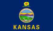
کانزاس
ظاهر
کانزاس | |
|---|---|
| State of Kansas | |
| لقب(لر): | |
| Motto(s): Ad astra per aspera (Latin for To the stars through difficulties) | |
| میلی مارش: "Home on the Range" | |
 کانزاس ایله بیرلشمیش ایالتلرین نقشهسی | |
| اؤلکه | بیرلشمیش ایالتلر |
| دؤولتچیلیکدان قاباق | Kansas Territory |
| بیرلیه قبول ائدیلدی | January 29, 1861 (34th) |
| پایتخت | توپکا |
| بؤیوک شهر | ویچیتا |
| بویوک مئتروپولیتنی | Kansas portion of Kansas City, MO-KS area[a] |
| ایداره | |
| • فرمانداری | لاورا کلی (د) |
| • موعاوینی | David Toland (D) |
| قانون قویانلار | Kansas Legislature |
| • یوخاری مجلیس | Senate |
| • آشاغی مجلیس | House of Representatives |
| محکمه | Kansas Supreme Court |
| سناتورلار | جری مورن (ج) روجر مارزهال (سیاستچی) (ج) |
| کونقرهنین نوماینده هئیتی | 1: ترئیسی مان (ج) 2: جیک لاتورنر (ج) 3: Sharice Davids (د) 4: رون زتز (ج) (list) |
| اراضی | |
| • جمع | ۸۲٬۲۷۸[۳] sq mi (۲۱۳٬۱۰۰ km2) |
| • توپراق | ۸۱٬۷۵۹[۳] sq mi (۲۱۱٬۷۵۴ km2) |
| • سو | ۵۲۰[۳] sq mi (۱٬۳۴۶ km2) 0.6[۴]% |
| مساحت درجهسی | 15th |
| Dimensions | |
| • اوزونلوق | ۲۱۳[۵] mi (۳۴۳ km) |
| • ائن | ۴۱۰[۵] mi (۶۶۰ km) |
| اوجالیق | ۲٬۰۰۰ ft (۶۱۰ m) |
| لاپ اوجا یئری | ۴٬۰۴۱ ft (۱٬۲۳۲ m) |
| لاپ چوخور یئری | ۶۷۹ ft (۲۰۷ m) |
| جمعیت (2020) | |
| • جمع | ۲٬۹۴۰٬۸۶۵ |
| • درجهسی | 36th |
| • سیخلیق | ۳۴٫۹/sq mi (۱۳٫۵/km2) |
| • سیخلیق درجهسی | 40th |
| • عائیله گلیرلرینین اورتاسی | $۵۶٬۴۲۲[۸] |
| • گلیر درجهسی | ۲۷th[۹] |
| دمونیم | Kansan |
| دیل | |
| • رسمی دیل | اینگیلیس[۱۰] |
| Time zones | |
| Majority of state | یوتیسی −06:00 (Central) |
| • یای (DST) | یوتیسی −05:00 (CDT) |
| Greeley, Hamilton, Sherman, and Wallace counties | یوتیسی −07:00 (Mountain) |
| • یای (DST) | یوتیسی −06:00 (MDT) |
| یواسپیاس ایختیصاری | KS |
| ایزو ۳۱۶۶ کودو | US-KS |
| قدیمی ایختیصاری | Kan., Kans. |
| عرض جوغرافیایی | 37° N to 40° N |
| طول جوغرافیایی | 94° 35′ W to 102° 3′ W |
| وئب سایت | portal |
| کانزاس ایالتینین نیشانلاری | |
|---|---|
 | |
 | |
| یاشایان نیشانی | |
| دوزیستلر | Barred tiger salamander |
| قوش | Western meadowlark |
| گول | Wild sunflower |
| Grass | Little bluestem |
| حشرات | Western honey bee |
| مهمهلی | American bison |
| سورونن | Ornate box turtle |
| آغاج | Plains cottonwood |
| Inanimate insignia | |
| تورپاق | Harney silt loam (unofficial) |
| State route marker | |
 | |
| State quarter | |
 Released in 2005 | |
| بیرلشمیش ایالتلرین ایالت نیشانلارینین لیستی | |
کانزاس (اینگیلیسجه: Kansas؛ /ˈkænzəs/ (![]() )) آمریکا بیرلشمیش ایالتلر اؤلکه سینین بیر ایالتی دیر.
)) آمریکا بیرلشمیش ایالتلر اؤلکه سینین بیر ایالتی دیر.
نوتلار
[دَییشدیر]- ^ The Kansas City area is the largest metropolitan and urban area in the state alone; however, the Wichita metropolitan area is the largest centered in the state.
قایناقلار
[دَییشدیر]- ^ Riney-Kehrberg, Pamela. "Wholesome, Home-Baked Goodness: Kansas, the Wheat State" (PDF). Kansas History: A Journal of the Central Plains. Kansas State Historical Society (Spring 2011): 60–69.
- ^ "Error: no
|title=specified when using {{Cite web}}". https://www2.ljworld.com/news/2010/mar/07/new-vanity-tag-rule-spurs-drivers-creativity/. - ^ ۳٫۰ ۳٫۱ ۳٫۲ Geography, US Census Bureau. State Area Measurements and Internal Point Coordinates.
- ^ USGS, Howard Perlman. Area of each state that is water.
- ^ ۵٫۰ ۵٫۱ Kansas Geography from NETSTATE.
- ^ ۶٫۰ ۶٫۱ Elevations and Distances in the United States. United States Geological Survey (2001). آرشیولنیب اصلی نۆسخهدن on 2011-10-15. یوْخلانیلیب2021-08-21.
- ^ ۷٫۰ ۷٫۱ Elevation adjusted to North American Vertical Datum of 1988.
- ^ Median Annual Household Income.
- ^ Bureau, U. S. Census. U.S. Census website.
- ^ Governor's Signature Makes English the Official Language of Kansas. US English (May 11, 2007).
خاریجی لینکلر
[دَییشدیر]| Kansas ویکیپدیانین باجی پروژهلرینده | |
| |
- State of Kansas
- کانزاس Curlie دا
- Kansas Travel and Tourism Division
- Kansas Historical Society
- Kansas Memory—documents, photographs, and other primary sources provided by the Kansas Historical Society
- Kansas State Agency Databases—Annotated list of searchable databases produced by Kansas state agencies
- USGS real-time, geographic, and other scientific resources of Kansas Archived 2006-12-30 at the Wayback Machine.
- Kansas State Facts from USDA
نقشهلر
- Kansas Highway Map (PDF), KSDOT, 2019.
- Kansas Railroad Map (PDF), KSDOT, 2019.
- "Access state, county, city, railroad, and other maps", Kansas Memory (digital portal), the Kansas State Historical Society.
 کانزاس جوغرافیا دادهلری اوپناستریتمپ ده
- "Kansas Maps", Perry–Castañeda Library (map collection), The University of Texas.
| قاباقکی اورقن |
List of U.S. states by date of statehood Admitted on January 29, 1861 (34th) |
سونراکی غرب ویرجینیا ایالتی |
بؤلمهلر:
- Articles with incorrect citation syntax
- Pages including recorded pronunciations
- گیزلی ویکیدئیتا ایله باجی پروژه باغلانتیلاریندان ایستیفاده ائدن صفحهلر
- Pages using Sister project links with default search
- BNC شناسهسیله مقالهلر
- MusicBrainz area شناسهسیله مقالهلر
- CINII شناسهسیله مقالهلر
- NARA شناسهسیله مقالهلر
- کانزاس
- ۱۸۶۱ میلادی ایلده قورولانلار کانزاس
- اورتا غرب بیرلشمیش ایالتلر
- ۱۸۶۱ میلادی ایلده قورولان بؤلگهلر و اؤلکهلر
- بیرلشمیش ایالتلرین ایالتلری
- U.S. states with multiple time zones
- Contiguous United States


