بلچلی
ظاهر
| Bletchley | |
|---|---|
 Queensway, the main shopping street in Bletchley. | |
| لوآ خطاسیماژول:Location_map-ین 522-جی/جو خطینده: Unable to find the specified location map definition: "Module:Location map/data/United Kingdom Milton Keynes" does not exist. | |
| جمعیت | ۳۳٬۹۵۰ [۱] 37,520 (2011 Census')[۲] |
| OS grid reference | SP872336 |
| • لندن | 43m |
| Unitary authority | |
| Ceremonial county | |
| Region | |
| اؤلکه | England |
| موستقیل دوولت | United Kingdom |
| Post town | MILTON KEYNES |
| Postcode district | MK1-3 |
| تیلفون کودو | 01908 |
| UK Parliament | |
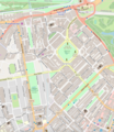
بلچلی (اینگیلیسیجه: Bletchley) بریتانیادا بیر یاشاییش منطقهسیدیر سوْن نۆفوس تخمینلرینه گؤره 33950 نفر دیر. بۇ شهر اینگیلیس اؤلکهسینده یئرلشیب.
گؤرونتولر
[دَییشدیر]بیرده باخ
[دَییشدیر]قایناقلار
[دَییشدیر]- ^ Milton Keynes Settlements – Population Projections 2001 to 2011 (using data for Blue Lagoon Park, Brickfields, Central Bletchley, Denbigh East, Denbigh North, Denbigh West, Far Bletchley, Granby, Mount Farm, Water Eaton and West Bletchley). Milton Keynes intelligence Observatory. Milton Keynes Council Environment Directorate (28 January 2005). یوْخلانیلیب5 October 2006.[دائمی اولو باغلانتیلی]
- ^ Total of Bletchley and Fenny Stratford also West Bletchley parish populations 2011
| بو شهرلر ایله باغلی مقاله، بیر قارالاما مقاله دیر. بونو گئنیشلندیرمکله ویکیپدیایا کؤمک ائده بیلرسینیز. |


