وستون-سوپر-مار
ظاهر
| Weston-super-Mare | |
|---|---|
 Weston-super-Mare bay and pier | |
| جمعیت | ۷۶٬۱۴۳ (2011 Census)[۱] |
| OS grid reference | ST320613 |
| Civil parish |
|
| Unitary authority | |
| Ceremonial county | |
| Region | |
| اؤلکه | England |
| موستقیل دوولت | United Kingdom |
| Post town | WESTON-SUPER-MARE |
| Postcode district | BS22–BS24 |
| تیلفون کودو | 01934 |
| UK Parliament | |
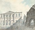
وستون-سوپر-مار (اینگیلیسیجه: Weston-super-Mare) بریتانیادا بیر یاشاییش منطقهسیدیر سوْن نۆفوس تخمینلرینه گؤره 76143 نفر دیر. بۇ شهر اینگیلیس اؤلکهسینده یئرلشیب.
گؤرونتولر
[دَییشدیر]بیرده باخ
[دَییشدیر]قایناقلار
[دَییشدیر]- ^ 2011 Census Profile (Excel). North Somerset Council. آرشیولنیب اصلی نۆسخهدن on 4 January 2014. یوْخلانیلیب4 January 2014.
| بو شهرلر ایله باغلی مقاله، بیر قارالاما مقاله دیر. بونو گئنیشلندیرمکله ویکیپدیایا کؤمک ائده بیلرسینیز. |


