
بریتانیا خاریجی تورپاقلاری
بریتانیا خاریجی تورپاقلاری | |
|---|---|
.svg) | |
_in_the_World_(%2BAntarctica_claims).svg) Location of the United Kingdom and the British Overseas Territories | |
| بؤیوک settlements | George Town, جبل الطارق, Road Town |
| رسمی دیل | اینگیلیس دیلی |
| دمونیم(لر) | British, Briton |
| Territories | |
| باشچیلار | |
• Monarch | ایکینجی الیزابت |
| Jeremy Hunt | |
• Minister of State | Tariq Ahmad |
• Minister of State | Alan Duncan |
| اراضی | |
• جمعی | لوآ خطاسیماژول:Convert-ین 1851-جی/جو خطینده: attempt to index local 'en_value' (a nil value). |
| جمعیت | |
• ۲۰۱۰ تخمینی | 250,000 |
| تاریخ فورمتی | dd/mm/yyyy (AD) |
بریتانیا خاریجی تورپاقلاری اینگیلیسجه: British Overseas Territories (قیساسی: BOTs)و یا بیرلشمیش شاهلیق خاریجی تورپاقلاری اینگیلیسجه: United Kingdom Overseas Territories [قیساسی: UKOTs)، بیرلشمیش شاهلیقین صلاحیتی و حاکمیتینه آلتیندا ۱۴ اراضی دیر.[۱][۲]
ایندیکی خاریجی تورپاقلار[دَییشدیر]
بریتانیا خاریجی تورپاقلارین اوندوردو:[۳]
| بایراق | نشان | آد | یئر | شوعار | اراضی | اهالی | پایتخت |
|---|---|---|---|---|---|---|---|
|
.svg) |
Akrotiri and Dhekelia | Cyprus, آرالیق دنیزی | ۲۵۵ km2 (۹۸ sq mi)[۴] | 7,700 (Cypriots; estimate) 8,000 non-permanent (UK military personnel and their families; estimate) |
Episkopi Cantonment | |
 |
 |
آنقیلیا | Caribbean, North اطلس اوقیانوسو | "Strength and Endurance" | ۹۱ km2 (۳۵٫۱ sq mi)[۵] | 13,500 (2006 estimate)[۶] | The Valley |
 |
 |
برمودا | North Atlantic Ocean between the Azores, the Caribbean, Cape Sable Island and کانادا | "Quo fata ferunt" (لاتین دیلی; "Whither the Fates carry [us]") | ۵۴ km2 (۲۰٫۸ sq mi)[۷] | 64,000 (2007 estimate)[۸] | Hamilton |
 |
 |
British Antarctic Territory | جنوبی قوطب | "Research and discovery" | ۱٬۷۰۹٬۴۰۰ km2 (۶۶۰٬۰۰۰ sq mi)[۵] | 0 50 non-permanent in winter, over 400 in summer (research personnel)[۹] |
Rothera (main base) |
 |
 |
بریتانیا اراضیسی هیند اوقیانوسوندا | هیند اوقیانوسو | "In tutela nostra Limuria" (لاتین دیلی; "Limuria is in our charge") | ۴۶ km2 (۱۸ sq mi)[۱۰] | 0 3,000 non-permanent (UK and US military and staff personnel; estimate)[۱۱] |
Diego Garcia (base) |
 |
 |
بریتانیا ویرجین آدالاری | Caribbean, North Atlantic Ocean | "Vigilate" (لاتین دیلی; "Be watchful") | ۱۵۳ km2 (۵۹ sq mi)[۱۲] | 27,000 (2005 estimate)[۱۲] | Road Town |
 |
کئیمن آدالاری | Caribbean | "He hath founded it upon the seas" | ۲۶۴ km2 (۱۰۱٫۹ sq mi)[۱۳] | 56,092 (2013 estimate)[۱۳] | George Town | |
 |
 |
فالکلند آدالاری | South Atlantic Ocean | "Desire the right" | ۱۲٬۱۷۳ km2 (۴٬۷۰۰ sq mi)[۷] | 2,955 (2006 census)[۱۴] 1,350 non-permanent (UK military personnel; 2012 estimate) |
Stanley |
 |
 |
جبل الطارق | Iberian Peninsula, Continental Europe | "Nulli expugnabilis hosti" (لاتین دیلی; "No enemy shall expel us") | ۶٫۵ km2 (۲٫۵ sq mi)[۱۵] | 28,800 (2005 estimate)[۱۶] 1,250 non-permanent (UK military personnel; 2012 estimate) |
جبل الطارق |
 |
 |
مونتسرات | Caribbean, North Atlantic Ocean | "A people of excellence, moulded by nature, nurtured by God" | ۱۰۱ km2 (۳۹ sq mi)[۱۷] | 4,655 (2006 estimate)[۱۷] | Plymouth (abandoned due to volcano—de facto capital is Brades) |
 |
 |
پیتکرن آدالاری | Pacific Ocean | ۴۷ km2 (۱۸ sq mi)[۱۸] | 49 (2014 estimate)[۱۹] 6 non-permanent (2014 estimate)[۲۰] |
Adamstown | |
|
سنت هلنا، اسنشن و تریستان دا کونا, including: |
South Atlantic Ocean | ۴۲۰ km2 (۱۶۲ sq mi) | 5,530 (total; estimate) | Jamestown | ||
 |
 |
Saint Helena | "Loyal and Unshakeable" (Saint Helena) | 4,255 (Saint Helena; 2008 census)[۲۱] | |||
 |
 |
Ascension Island | 880 (Ascension; estimate)[۲۲] 1,000 non-permanent (Ascension; UK military personnel; estimate)[۲۲] |
||||
 |
 |
Tristan da Cunha | "Our faith is our strength" (Tristan da Cunha) | 300 (Tristan da Cunha; estimate)[۲۲] 9 non-permanent (Tristan da Cunha; weather personnel) |
|||
 |
 |
South Georgia and the South Sandwich Islands | South Atlantic Ocean | "Leo terram propriam protegat" (لاتین دیلی; "Let the lion protect his own land") | ۴٬۰۶۶ km2 (۱٬۵۷۰ sq mi)[۲۳] | 0 99 non-permanent (officials and research personnel)[۲۴] |
King Edward Point |
 |
تورکس و کایکوس آدالاری | Lucayan Archipelago, North Atlantic Ocean | ۴۳۰ km2 (۱۶۶ sq mi)[۲۵] | 32,000 (2006 census)[۲۵] | Cockburn Town | ||
| Overall | 1,727,570 km2 | ت 250,000 |
نقشه[دَییشدیر]

British Overseas Territories
United Kingdom
قایناقلار[دَییشدیر]
- ^ Supporting the Overseas Territories. UK Government. یوْخلانیلیب8 November 2014. “There are 14 Overseas Territories which retain a constitutional link with the UK. .... Most of the Territories are largely self-governing, each with its own constitution and its own government, which enacts local laws. Although the relationship is rooted in four centuries of shared history, the UK government's relationship with its Territories today is a modern one, based on mutual benefits and responsibilities. The foundations of this relationship are partnership, shared values and the right of the people of each territory to choose to freely choose whether to remain a British Overseas Territory or to seek an alternative future.”
- ^ What is the British Constitution: The Primary Structures of the British State. The Constitution Society. آرشیولنیب اصلی نۆسخهدن on 6 October 2014. یوْخلانیلیب15 November 2014. “The United Kingdom also manages a number of territories which, while mostly having their own forms of government, have the Queen as their head of state, and rely on the UK for defence and security, foreign affairs and representation at the international level. They do not form part of the UK, but have an ambiguous constitutional relationship with the UK.”
- ^ Overseas Territories. UK Overseas Territories Foreign & Commonwealth Office. آرشیولنیب اصلی نۆسخهدن on 23 June 2012. یوْخلانیلیب8 December 2010.
- ^ SBA Cyprus. Jncc.gov.uk. آرشیولنیب اصلی نۆسخهدن on 2018-12-25. یوْخلانیلیب8 December 2010.
- ^ ۵٫۰ ۵٫۱ British Antarctic Territory. Jncc.gov.uk. آرشیولنیب اصلی نۆسخهدن on 2018-12-25. یوْخلانیلیب8 December 2010.
- ^ Commonwealth Secretariat – Anguilla. Thecommonwealth.org. آرشیولنیب اصلی نۆسخهدن on 17 December 2010. یوْخلانیلیب8 December 2010.
- ^ ۷٫۰ ۷٫۱ UNdata | record view | Surface area in km2. United Nations (4 November 2009). یوْخلانیلیب8 December 2010.
- ^ Bermuda. Jncc.gov.uk. آرشیولنیب اصلی نۆسخهدن on 2018-12-25. یوْخلانیلیب8 December 2010.
- ^ Commonwealth Secretariat – British Antarctic Territory. Thecommonwealth.org. آرشیولنیب اصلی نۆسخهدن on 5 June 2011. یوْخلانیلیب8 December 2010.
- ^ British Indian Ocean Territory. Jncc.gov.uk. آرشیولنیب اصلی نۆسخهدن on 2018-12-25. یوْخلانیلیب8 December 2010.
- ^ Commonwealth Secretariat – British Indian Ocean Territory. Thecommonwealth.org. آرشیولنیب اصلی نۆسخهدن on 5 June 2011. یوْخلانیلیب8 December 2010.
- ^ ۱۲٫۰ ۱۲٫۱ British Virgin Islands (BVI). Jncc.gov.uk. آرشیولنیب اصلی نۆسخهدن on 2010-10-13. یوْخلانیلیب8 December 2010.
- ^ ۱۳٫۰ ۱۳٫۱ The World Factbook: Cayman Islands. CIA. آرشیولنیب اصلی نۆسخهدن on 2016-02-13. یوْخلانیلیب7 September 2016.
- ^ Commonwealth Secretariat – Falkland Islands. Thecommonwealth.org (14 June 1982). آرشیولنیب اصلی نۆسخهدن on 13 May 2011. یوْخلانیلیب8 December 2010.
- ^ Gibraltar. Jncc.gov.uk. آرشیولنیب اصلی نۆسخهدن on 2018-12-25. یوْخلانیلیب8 December 2010.
- ^ Commonwealth Secretariat – Gibraltar. Thecommonwealth.org (7 November 2002). آرشیولنیب اصلی نۆسخهدن on 6 March 2010. یوْخلانیلیب8 December 2010.
- ^ ۱۷٫۰ ۱۷٫۱ Montserrat. Jncc.gov.uk. آرشیولنیب اصلی نۆسخهدن on 2010-10-13. یوْخلانیلیب8 December 2010.
- ^ Pitcairn Island. Jncc.gov.uk. آرشیولنیب اصلی نۆسخهدن on 2018-12-25. یوْخلانیلیب8 December 2010.
- ^ Rob Solomon and Kirsty Burnett (January 2014) Pitcairn Island Economic Review Archived 2014-10-06 at the Wayback Machine.. government.pn. Retrieved 7 September 2016.
- ^ "Pitcairn Residents". puc.edu. Retrieved 7 September 2016.
- ^ UN Statistics – St Helena census 2008. United Nations. آرشیولنیب اصلی نۆسخهدن on 29 June 2014. یوْخلانیلیب4 January 2011.
- ^ ۲۲٫۰ ۲۲٫۱ ۲۲٫۲ "St Helena, Ascension, Tristan da Cunha profiles". BBC. 16 March 2016. https://www.bbc.co.uk/news/world-africa-14123532. Retrieved 25 June 2016.
- ^ Vital Statistics – SOUTH GEORGIA AND THE SOUTH SANDWICH ISLANDS Archived 2016-01-31 at the Wayback Machine.. 22 January 1993. CIA WORLD FACTBOOK 1992 via the Libraries of the Univ. of Missouri-St. Louis.
- ^ Population of Grytviken, South Georgia and the South Sandwich Islands. Population.mongabay.com (31 March 2009). آرشیولنیب اصلی نۆسخهدن on 17 July 2011. یوْخلانیلیب8 December 2010.
- ^ ۲۵٫۰ ۲۵٫۱ Turks and Caicos Islands. Jncc.gov.uk (1 November 2009). آرشیولنیب اصلی نۆسخهدن on 2012-09-12. یوْخلانیلیب8 December 2010.
علاوه اوخو[دَییشدیر]
- Charles Cawley. Colonies in Conflict: The History of the British Overseas Territories (2015) 444pp
- Harry Ritchie, The Last Pink Bits: Travels Through the Remnants of the British Empire (London: Hodder & Stoughton, 1997)
- Simon Winchester, Outposts: Journeys to the Surviving Relics of the British Empire (London & New York, 1985)
- George Drower, Britain's Dependent Territories (Dartmouth, 1992)
- George Drower, Overseas Territories Handbook (London: TSO, 1998)
- Ian Hendry and Susan Dickson, "British Overseas Territories Law" (London: Hart Publishing, 2011)
- Ben Fogle, The Teatime Islands: Adventures in Britain's Faraway Outposts (London: Michael Joseph, 2003)
- Bonham C. Richardson (16 January 1992). The Caribbean in the Wider World, 1492–1992. Cambridge University Press. 8 December 2010-ده یوخلانیب.
خاریجی لینکلر[دَییشدیر]
قارداش پروژهلرده بریتانیا خاریجی تورپاقلاری گؤره داها آرتیق بیلگیلر تاپابیلرسینیز.
| ویکیآمباردا British overseas territories ایله مربوط فایل وار. |
- Foreign and Commonwealth Office – UK Overseas Territories
- United Kingdom Overseas Territories Association
- British Overseas Territories Act 2002 – Text of the Act
اینگیلیس دیلی دانیشان اؤلکهلر | |||||||||||||||||||||||||||||||||||||||
|---|---|---|---|---|---|---|---|---|---|---|---|---|---|---|---|---|---|---|---|---|---|---|---|---|---|---|---|---|---|---|---|---|---|---|---|---|---|---|---|
اؤلکهده و یا بؤلگهده اینگیلیس دیلینده اولان بیر مقالهنی گؤرمک اوچون رنگلی اراضیه باسین 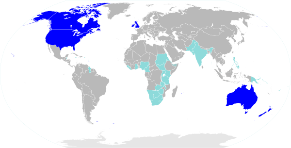 | |||||||||||||||||||||||||||||||||||||||